Cave Hill Cemetery – Louisville, Kentucky

The grounds of Cave Hill Cemetery in Louisville, Kentucky contain over 120,000 burials. Office staff are friendly and willing to give you directions to interesting gravesites.

Cave Hill Cemetery Sign

A Pleasant Journey Through Cave Hill Cemetery

From the time I drove onto the grounds of Cave Hill Cemetery in Louisville, Kentucky, I was greeted by friendly staff members willing to give directions to several of the more interesting gravestones on the property.

1) Muhammad Ali

Office workers looked at me with a knowing smile on this hot summer afternoon.  They knew why I was here.  It was a few days after the summer solstice.  I was on my way home from a Cemetery Conference in Columbus, Ohio.  Cemetery workers were perplexed that I wasn’t focused on any single grave site.  I just wanted to have a good look around. Eventually, one of the office members indicated the direction to Muhammad Ali’s gravesite.  Finally, I understood their confusion. “Ohhhh…”, I thought, “Muhammad Ali is buried here!” While following a seady line of cars, I easily found my way to his grave site.  

Muhammad_Ali

Muhammed Ali died only a few weeks before my visit.  Although his gravestone had yet to be placed, I visited his burial location.  Since my visit, his gravestone has been placed.  If you visit Cave Hill, please share your pictures of Muhammad Ali’s grave site with me.

2) Harland Sanders

Harland Sanders developed the Kentucky Fried Chicken chain of restaurants. Colonel Sanders is surrounded by family.  Margaret Sanders has a most beautiful verse inscribed into her gravestone.  
Watch the video below to see the inscription.
Harland Sanders

margaret_sanders

3) Harry Collins

Harry Collins is honored with a delightful grave marker designed by Barney Bright.  A life-long Magician, Harry traveled the world promoting the Frito Lay Company. His grave marker perfectly describes Harry’s delightful presence.
harry_collins

I could easily spend hours exploring the miles of roadways in Cave Hill Cemetery.  However, I was able to take in many of the sights.  

The video below is a summary of my trip.

Please Enjoy this video of Cave Hill.

Kings Point Cemetery – Chattanooga, Tennessee

Kings Point Cemetery - Service Road

Kings Point Cemetery – Abandoned, Neglected, but not Forgotten

The sign on a rusty locked barricade warns of penalties for willful destruction or removal of U.S. Government property but “No Tresspassing” signs are not to be found. This service road does not appear on roadway maps. Conversely, the documented road (Pine Street) located 1/4 mile away from this location still exists on maps but no longer exists in reality.

Why has Pine Street, the main road leading into Kings Point Cemetery, vanished from reality? And, why has Kings Point Cemetery fallen into such a state of abandonment?

Kings Point Cemetery in Hamilton County, Tennessee dates back to 1830

A once prestigious cemetery containing notable figures in Chattanooga’s history, Kings Point Cemetery dates back to the mid 1800’s with some of the earliest burials from the Silvey family. As such; some local historians refer to the burial ground as Silvey Cemetery. It is on land now owned by the Tennessee Valley Authority.

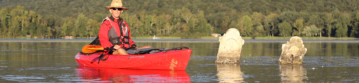
TVA first became prominent in this immediate area in the 1930s when Chickamauga Dam was built on the Tennessee River 6 miles upriver of Chattanooga, Tennessee. Kings Point’s setting is high atop a hill overlooking Chickamauga Dam. The cemetery’s perch saved it from the fate of many other cemeteries in the area flooded by rising waters of the Tennessee River. Once the hydroelectric dam was completed in 1940, rising lake levels caused the relocation of 24 cemeteries. To TVA’s credit, the Governmental Agency prides itself on being sensitive to cultural issues such as the impact from their operations on area cemeteries.

3_graves

In fact, TVA has responsibly moved more than 550 cemeteries, in total, within its jurisdictional boundaries.

Their efforts of building the dam required TVA to purchase much of the surrounding land. Kings Point was acquired in the 1930s and officially closed in 1938. According to a gravemarker survey performed in 1941, the last known burial was in 1933.
[EDIT 04/03/2018: In further research of Kingspoint Cemetery, I have found evidence of burials later than those in the survey referenced above. According to Find-A-Grave, Hugh Jackson Studdard was buried in Kingspoint Cemetery in 1946. Furthermore, Find-A-Grave references a burial as late as 1961.]

When Pine Street was placed into disuse, clear access into Kings Point Cemetery was no longer available.
kings_point_cemetery

Kingspoint Cemetery has since fallen into complete disrepair. With scores of sunken gravesites, toppled tombstones, and a collapsed mausoleum, extreme caution must be heeded by visitors. A thick carpet of Periwinkle obfuscates landscape contours. Voids and obstructions are not readily apparent.

sunken_grave

Of the few epitaphs which can be read, interesting stories emerge. A stark example is that of Sam Cleage Lumpkin who was “Murdered Over a Dog Fight.”

Notable Burials

The most notable burials in Kings Point are those of the Woodward Family.

In today’s world of instant sharing of selfie pics via Facebook and Instagram, we can only imagine piling the entire family into a horse-drawn wagon for a day-long outing to have a professional photographer shoot a group picture. However, in February 1897, 10 members of the Woodward family excitedly took a family excursion. They loaded 10 family members into a wagon pulled by the family’s two horses on their way to Chattanooga for a family photograph.

At the railroad tracks near Orchard Knob Avenue, the whistles and bells of an oncoming passenger train went unheeded by the wagon driver. 24 year old George T. Woodward encouraged his horses across the tracks but not before Southern Railway Engine No. 846 barrelled into them. Bodies of the family were, reportedly, thrown as high as telegraph wires. The sole surviving family member, 3 year old Vergie Woodward, was discovered unhurt on the engine that pulled the train. The next day’s newspaper headlines read: “NINE MEMBERS OF ONE FAMILY HURLED INTO ETERNITY.”

All 9 family members killed by the tragedy are buried in Kings Point.

Can you imagine the sadness which surrounded these gravesites on this hallowed ground 120 years ago?

With the proven cultural sensitivity TVA has provided cemeteries in the past, it seems responsible to reopen Pine Street allowing free access and rehabilitation efforts to take place at Kings Point Cemetery.


fenced_cemetery_plot

As with many abandoned cemeteries I visit, Kings Point is not included in Google Maps. I’ve suggested it to their database administrators in hopes it will be added soon. That said, the location map is included below. The cemetery is located on the map at the end of Pine Street which juts off Hwy 58.

Shaw Cemetery – Red Bank, Tennessee

Red Bank Cemetery

Shaw Cemetery AKA Red Bank Cemetery

It’s a familiar scenario. I’m driving on a road I’ve driven a hundred times before. All of a sudden, I look up and notice gravestones on a hillside. Thus is the tale of how I found this cemetery in Red Bank, Tennessee.

Cemetery Obscured By Trees

Just past Hardee’s on Morrison Springs Road heading into Red Bank, Tennessee, a small grove of trees covers a hillside behind a rental house. The property owner recently cleared scrub brush from the hillside to increase visibility around a difficult intersection. I’ve driven this road dozens of times but I’ve never known there to be a cemetery anywhere near here.

Loaded into my Garmin Nuvi GPS is a database of over 150,000 cemeteries. I use this as a backup to Google Maps and Billion Graves.  This GPS file helps me locate cemeteries. Although I’ve used this system to find hundreds of cemeteries all across the United States, I’ve never known about a cemetery in this area. However, with the scrub brush cut away, I caught a glimpse of a tombstone atop the hillside. I was so unaccustomed to seeing tombstones on this stretch of land that the vision through my eyes didn’t register in my brain until I almost reached the intersection at Dayton Boulevard. “HEY!!! There’s a cemetery up there.” Spinning around, I took a right on Oakland Terrace and then a 180° left onto a small side street. There, between and behind two residences is Red Bank Cemetery (the sign says “Shaw Cemetary[sic]”).

Red Bank Cemetery (Or Is It Shaw?)

The grave sites in Red Bank Cemetery date back as early as the late 1800s though the majority are from the mid 1900s. A survey of recorded grave markers can be found on the Hamilton County Genealogical Site Red Bank is a small enclave city completely surrounded by Chattanooga, Tennessee. Being so close to Chattanooga and the Civil War battles fought in the surrounding areas, I expected to see significant markers with names of civil war veterans. However, mentions of soldiers from the Civil War were difficult to find.

The cemetery is well maintained and is apparently still in somewhat modern use with the most recent marker reading a DOD 1997.

Whether it’s known as Shaw Cemetery or Red Bank Cemetery, I’m glad the property owner cleared away the trees giving greater visibility to this grave yard.

Red Bank Cemetery

gravestones in red_bank cemetery

Tilted Gravestone

As mentioned above, Red Bank Cemetery is not listed in the Google Maps database. As of the writing of this blog post (January 2017) I’ve submitted the location to Google and I hope it will be added soon.