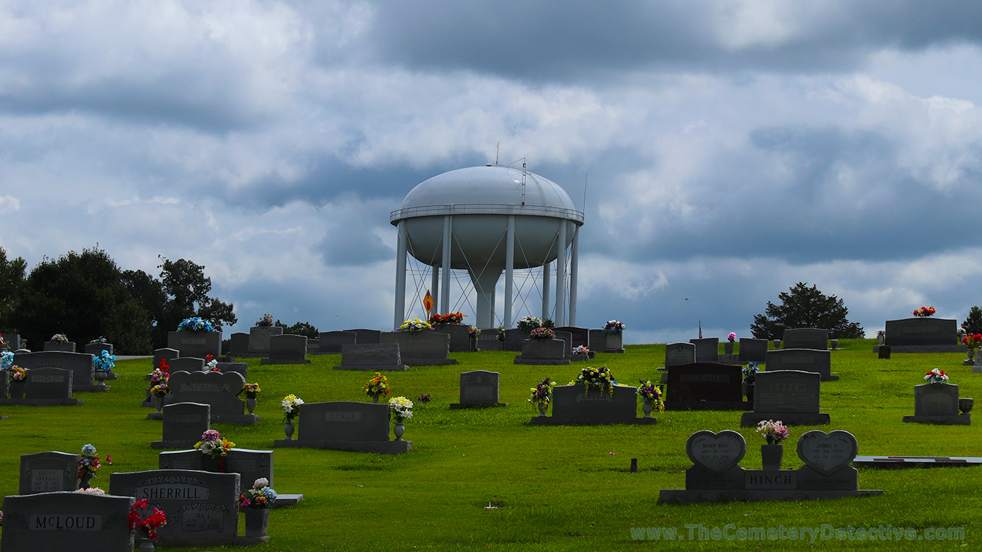
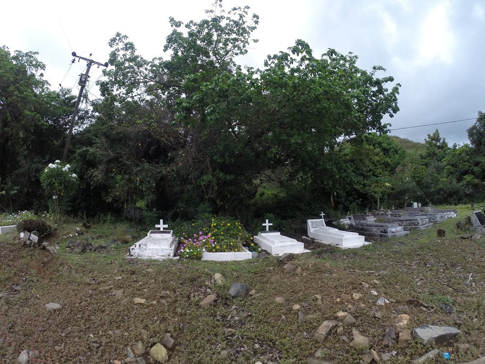
A water tower overlooking a cemetery adds a whole new dimension.
Cemetery and Water TowerI’m pretty sure I have a new fascination…water towers over cemeteries. I’ve seen quite a few, recently. I found this one while researching cemeteries around the “world’s largest tree house” also known as “The Minister’s Treehouse.” (link below).
I cannot see a water tower without thinking back to a version of the War Of The Worlds movie I saw on TV when I was a kid (maybe it was a rebroadcast of the 1953 film?) where a farmer shoots a water tower mistaking it for a martian.
Now, seeing water towers over cemeteries adds a whole new dimension.
holds their annual conference each year in June. In 2017, our group gathered in Tuscaloosa, Alabama. This year, 2018, we took the studies northward to Danbury, Connecticut.
Giving myself a few extra days for travel, I visited and studied cemeteries from Polk County, Tennessee through New York City and onward to Danbury.
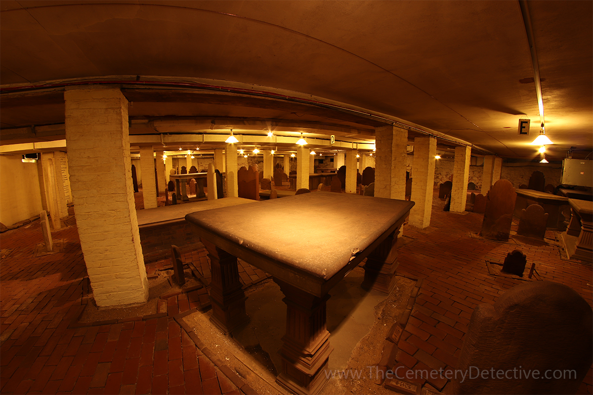
New Haven CryptThe range of topics at these conferences are wide and varied. This year’s offerings included many workshops including: gravestone preservation, cemetery photography, legal issues affecting graveyards, forensic studies of burials, and ground penetrating radar.
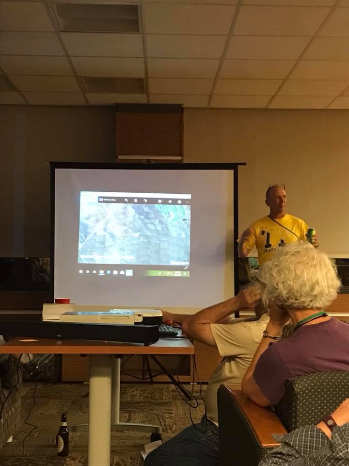
For my part of the conference, I revisited a daylong workshop I lead in 2016 on the art of cemetery mapping using various modern day technological tools including aerial 3D mapping using modern day drones. This year, my presentation was brief but quite a few people showed enough interest that I will consider leading a full-day workshop at a future conference.
Keith Presenting on the Lava Affected Cemeteries of HawaiiDuring the night-time hours, academics within the group present formal lectures. Afterward, during our late-night participation, informal lectures and slide shows are given.
Cemetery Presentations
Since the volcano eruption on Hawaii is in the news this year, I presented my work during a recent trip to Hawaii where I studied lava affected cemeteries on the Big Island. I loved my trip to study Hawaiian Cemeteries and I hope to make a return trip to Hawaii one day soon.
I am involved with studying cemeteries (in some capacity) on a daily basis. The AGS Conference is the one time of the year I am surrounded by other cemetery people for a week at a time. The breadth and depth of knowledge of these cemetery researchers is truly inspiring. I come away from each conference with newfound knowledge that I try to apply to my passion.
Increasingly, Civic Organizations, Churches, and Schools are asking me to give presentations of my cemetery research. I always try to exhibit the knowledge and enthusiasm I garner from my AGS conference trips.
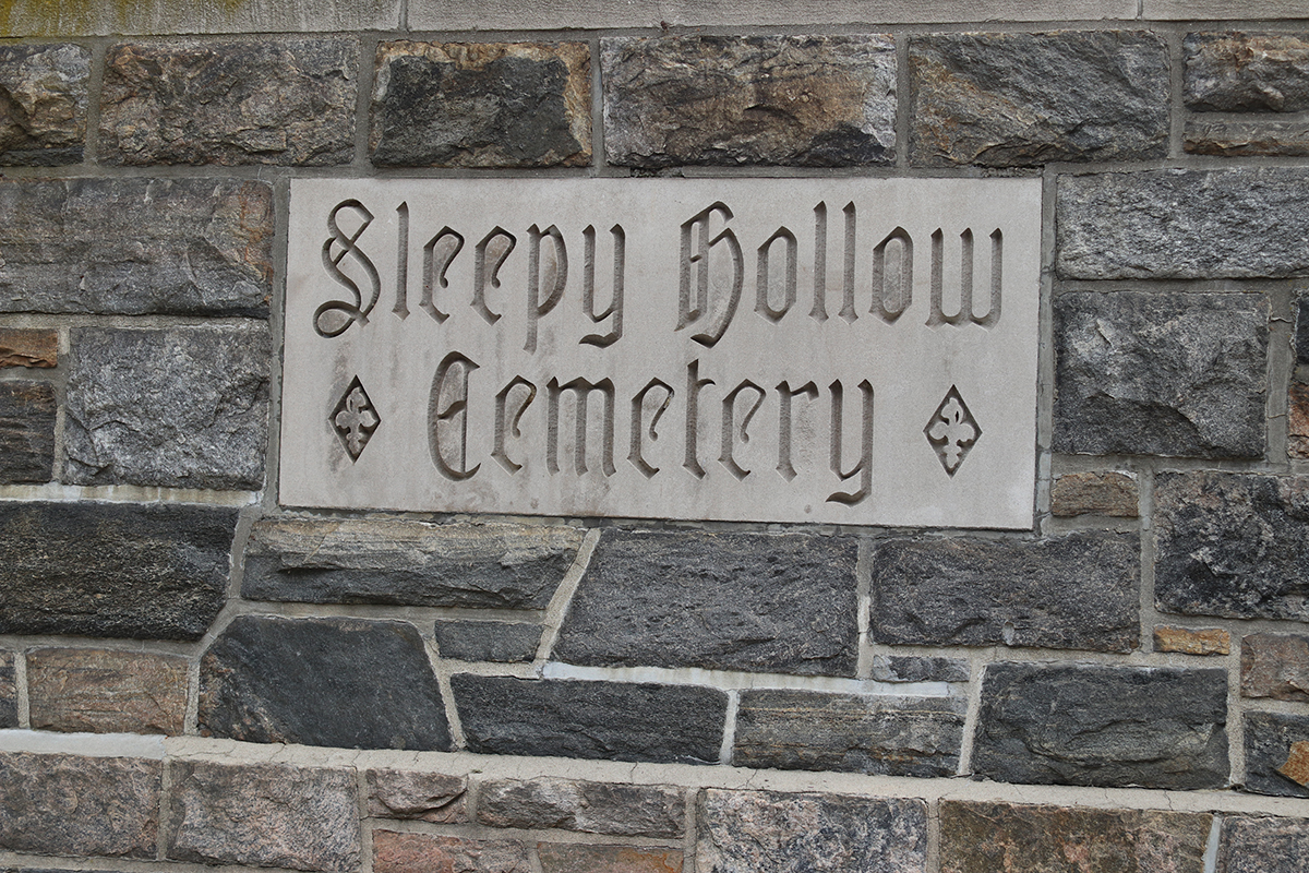
Sleepy Hollow CemeteryDriving back from Danbury, I visited quite a few cemeteries including Sleepy Hollow Cemetery and Stonewall Jackson Memorial Cemetery.
20 Cemeteries and a Cemetery Research Video
In all, I studied more than 20 cemeteries on this trip. At the bottom of this list is a short film I made of my travels.
Beckler Cemetery – Reliance, Tennessee
Double Springs Cemetery – Rock Springs, Tennessee
Beth El Cemetery – Harrisonburg City, Virginia
New York Marble Cemetery – New York, New York
Woodlawn Cemetery – Bronx, New York
Mill Plain Cemetery – Danbury, Connecticut
Resurrection Cemetery – Danbury, Connecticut
Kenosia Cemetery – Danbury, Connecticut
Wooster Cemetery – Danbury, Connecticut
New Haven Crypt – New Haven, Connecticut
Grove Street Cemetery – New Haven, Connecticut
Old Milford Cemetery – Milford, Connecticut
Sleepy Hollow Cemetery – Sleepy Hollow, New York
Millington Baptist Church Cemetery – Millington, New Jersey
St. Philip and St. James Cemetery – Greenwich Township, New Jersey
New Hope Congregational Christian Church Cemetery – New Hope, Virginia
Stonewall Jackson Memorial Cemetery – Lexington, Virginia
Goodman Cemetery – Bristol, Virginia
Necessary Cemetery – Scott County, Virginia
Zion Lutheran Church Cemetery – Bristol, Virginia
Niota Cemetery – Niota, Tennessee
Cedar Grove Cemetery – Athens, Tennessee
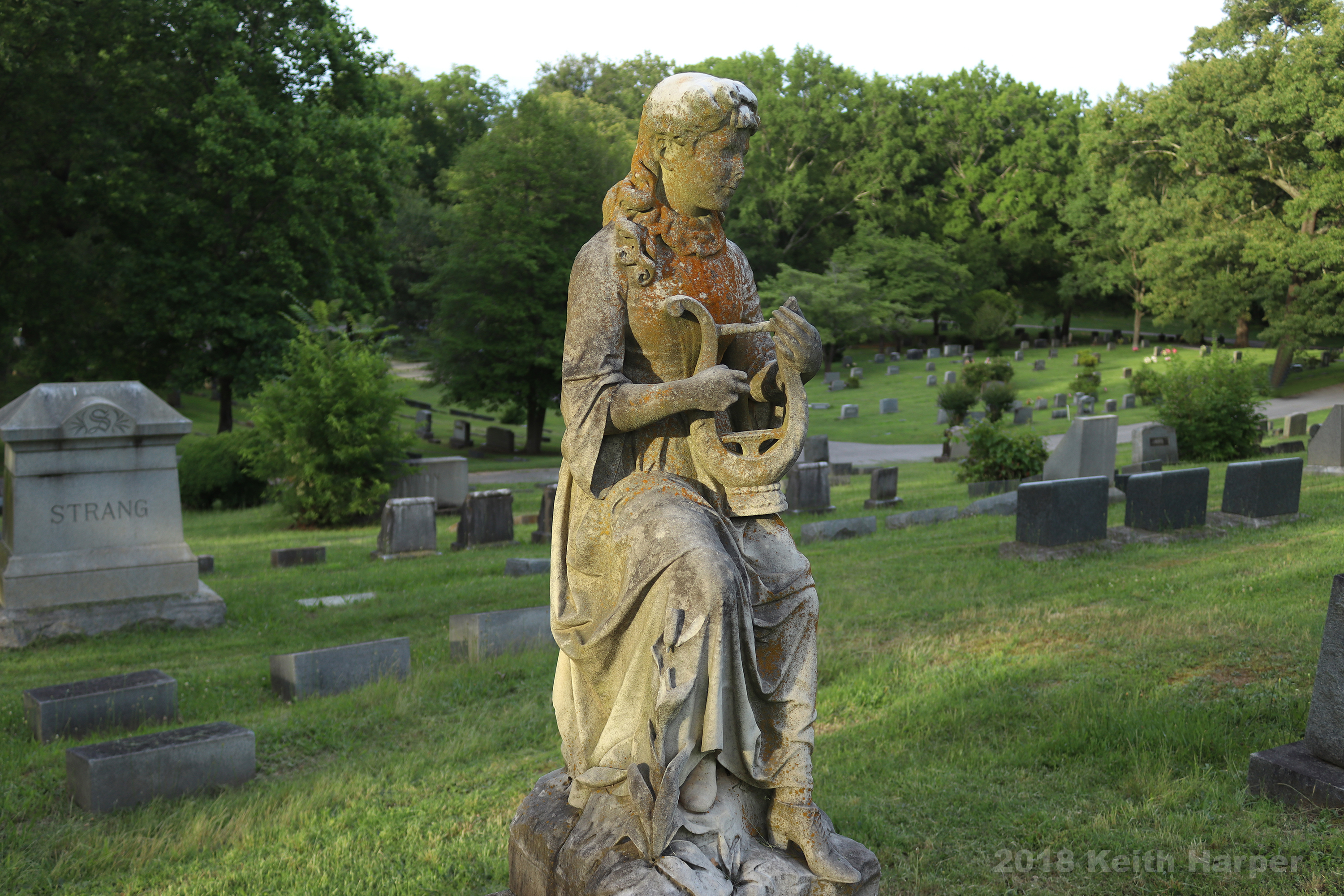
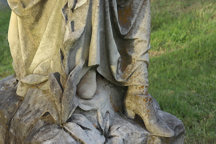
The heel on her left shoe. Substantial. Contacting the ground with stability.
And her right shoe. The delicate way its laces peek out from beneath her dress…a dress with sleeves flowing from elbow to thigh.Lyre on a Gravestone
Lyre on a GravestoneLyre on a Gravestone
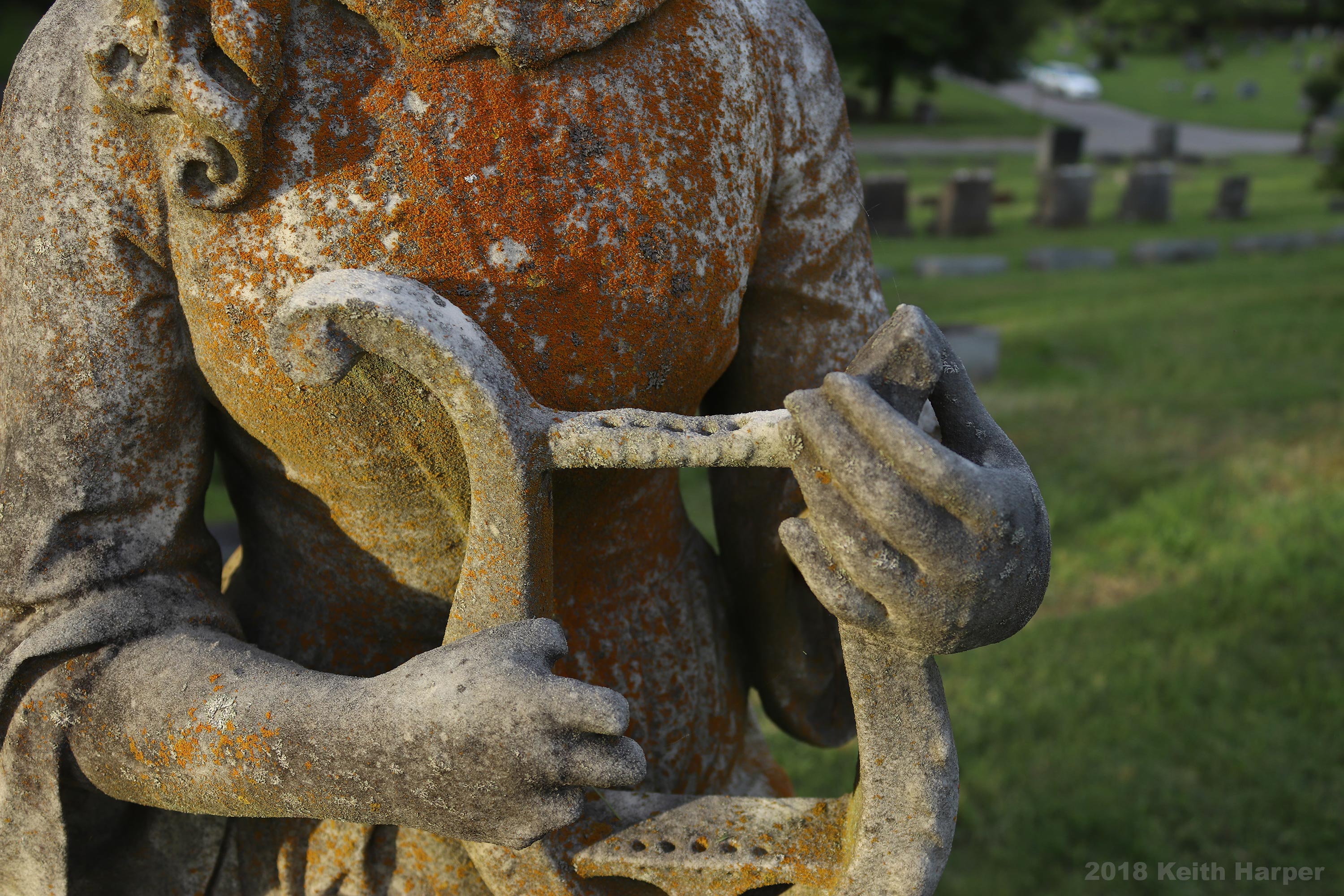
And her lyre.
An antiquated instrument often depicted with 7 strings but her’s has only 5. Or, at least, it has fittings for 5 strings if it ever had strings at all. Which brings into focus the name on the gravestone behind her. “Strang” the past-tense of string.
I smile, bemused, wondering if anyone else would notice such a thing.
The Cemetery Detective explores cemeteries between Bridgeport, Alabama and Haletown, Tennessee.
I first became fond of trains while visiting Great Britain the year after I graduated college. That summer, I rode trains all the way to the northern-most reaches of mainland Scotland to a small town called John O’ Groats. Only recently have I rediscovered my love of trains with my exploration of cemeteries around the TAG (Tennessee – Alabama – Georgia) Railroad line leading from Chattanooga, Tennessee to Gadsden, Alabama.
After the TAG Cemeteries Documentary was complete, I further investigated railroads and their relation to nearby cemeteries. As such, I began investigating a railroad line which runs from Haletown, Tennessee to Bridgeport, Alabama. Though I’ve driven under the Running Water Creek Railroad Bridge hundreds of times, I had not investigated its origin. When I began researching this bridge, I found a fascinatingly long history through several iterations of railroad bridges in this area. Below is my Cemetery Documentary on this railroad bridge, U.S. Civil War actions that affected previous bridges, the land of the Cherokee before Euro-Americans moved into the area, a local cornbread festival, and, of course, the culturally significant cemeteries that dot the surrounding landscape.
If you enjoy my cemetery research, please send me a message to let me know of your favorite cemetery. Perhaps I will visit it one day soon.
Best regards:
Keith
The Cemetery Detective explores cemeteries between Haletown, Tennessee and Bridgeport, Alabama.
Join Keith as he not only explores the cemeteries of this historically significant swath of Tennessee and Alabama but also delves into the history of the local communities.
Keith begins at the current Running Water Creek Railroad Bridge. The original bridge was built not far from here prior to the War Between The States. That bridge was demolished by Confederate Soldiers in an effort to stem the advance of Union forces moving into the area to take control of Chattanooga, TN. The bridge has lived through several iterations that fell victim to flood or old age. The current bridge was built in 1968. It is in daily use.
Keith also takes us to Whiteside, Tennessee. Prior to it being called Whiteside, the community was called Running Water. Determined Cherokee Tribal Leader Dragging Canoe lived here the final 10 years of his life. Dragging Canoe staged his struggle against Euro-Americans who were streaming onto Cherokee lands via the Federal Road.
Cemeteries dot the landscape within short distance of the railroad track that cuts through the countryside.
Hale Cemetery
Hale Cemetery
Ladds Switch Cemetery
Graham Cemetery
Clouse Cemetery
Burnett Cemetery
New Hope Cemetery
Whited Family Cemetery
Harris Chapel Cemetery
South Pittsburg City Cemetery
Patton Cemetery
Patton Cemetery Annex
Gunter Cemetery
Abbot Cemetery
Mount Carmel Cemetery
Rocky Springs Cemetery
Bonaventure Cemetery
While in Bridgeport, Alabama, Keith explores the Bridgeport Railroad Museum and is fascinated with the Bridgeport Lift Bridge.
Having crossed Running Water Creek Railroad Bridge earlier in the day, the train enters Bridgeport by crossing the Tennessee River only a few feet from a 1/4 mile long walking bridge.
As a final stop, Keith visits the Virgin of the Poor Shrine in New Hope, Tennessee.
I sped away from the city at lunchtime to search for an abandoned cemetery.
This is a selection on the Hunt for an Abandoned Cemetery from the JUNE 2018 Edition of “The Cemetery Detective” Fan Club Newsletter.
Fan Club subscription fees help Keith with expenses associated with his cemetery research, documentation, and cleanup efforts.
Join the Fan Club here: The Cemetery Detective Fan Club
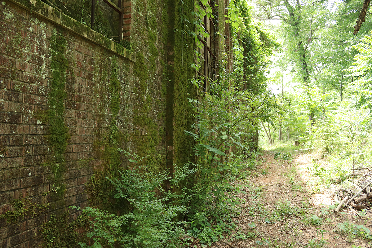
A One Hour Abandoned Cemetery Hunting Trip
I speed away from the city for lunch,
venturing deep into rural Tennessee.
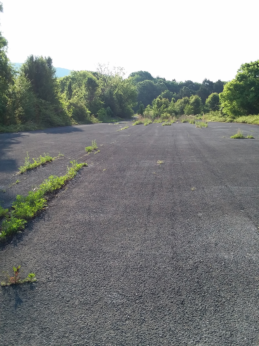
Onto an abandoned government road.
Ducking beneath a locked barricade.
Asphalt gives way to the constant creep of nature.
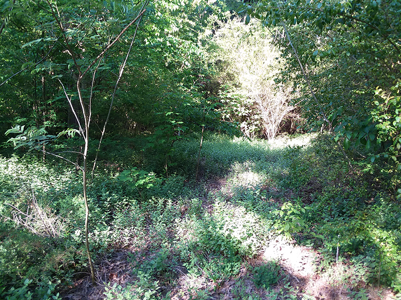
I scramble through brambles.
Briars cling to my clothing as if to grasp and keep me for their own.
Pricks and thorns dig into my skin as if to taste the pinprick drops of blood they elicit.
Clawing my way through scrub so dense a fox would not venture even if trying to outwit a pack of hounds, I am not deterred from my destination.
I find myself in an aromatic thicket of honeysuckle swarmed by bees.
Non-threatening buzzing alerts me to their presence.
They mind me not. I mind them not.
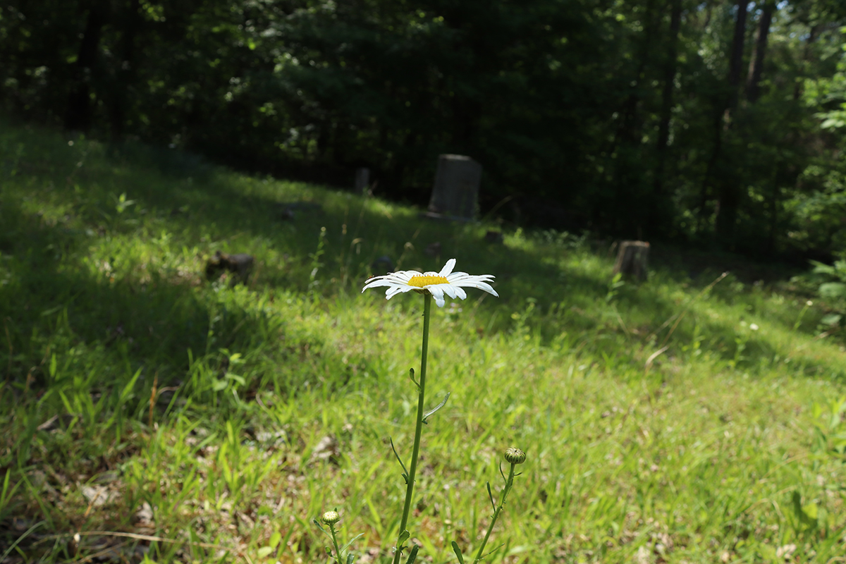
Honeysuckle gives way to field daisies.
Field daisies give way to periwinkle.
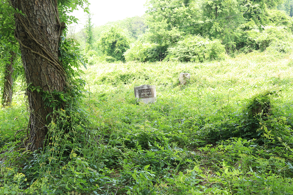
And, as nature opens up, I find my quest.
There, beyond the confines of an imperfectly laid stone wall, a single grave marker rises above the dense greenery.
I stand amazed at the splendor.
Transfixed by what I have found.
But, alas, a bee’s buzz and strong wafting honeysuckle fragrance
reminds me; lunch is almost over, I must get back to the city.
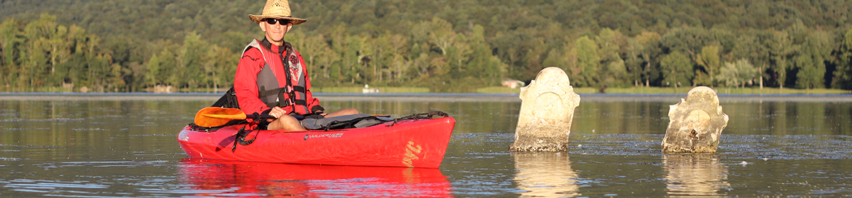
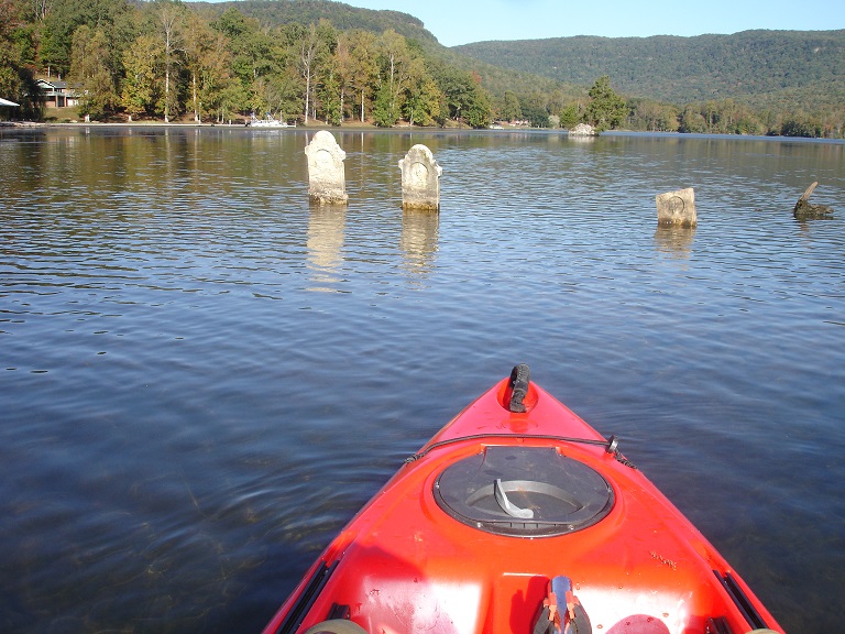
The Cemetery Detective explores Bell Cemetery and Skull Island Cemetery.
In this episode, The Cemetery Detective explores Bell Cemetery and Skull Island Cemetery. Keith has become fascinated with cemeteries that are affected by flood waters both natural and man-made. Keith kayaks on the Tennessee River from Chickamauga Dam upriver to Harrison Tennessee where he investigates homesteads that were flooded in 1940 after the dam’s completion. Bell Cemetery is on a wooded hilltop on John A Patten Island. From here, Keith paddles upriver past Sequoyah Nuclear Power Plant which overlooks Skull Island. Once on the shore of Skull Island, Keith investigates a cemetery and the grave sites that were moved from Norman-Eldridge Cemetery prior to 1940.
Chickamauga Dam Upriver of Chattanooga, TN
In 1936, the Tennessee Valley Authority began construction on the Chickamauga Dam a few miles upriver of Chattanooga, Tennessee.
As part of the dam’s construction and the eventual flooding and creation of Chickamauga Lake, TVA commissioned the relocation of grave sites from 24 cemeteries within this newly created flood plain. Chickamauga
dam was constructed using limestone from a nearby quarry. I am always interested in visiting area quarries. Understanding an area’s geology allows me to find similarities in rock used by local gravestone carvers.
Old Harrison, Tennessee
Chickamauga Dam was completed in 1940. The waters began to rise immediately flooding several communities. One of these flooded communities was the town of Old Harrison, Tennessee. Long before the waters came up and overtook their land, residents made provisions to move to higher ground. In the final days, town residents threw elaborate parties celebrating the fact that their land would be consumed by the lake.
One of Chickamauga Dam’s purposes is to provide downstream flood control of the greater Chattanooga area. As part of their flood control initiative, TVA lowers lake levels during winter months. Areas of Old Harrison that are submerged in summer are visible from November through mid-April. Exploring during this time of year lead to my finding abandoned foundations and a few relics of years-gone-by. In Old Harrison, I discovered an old asphalt roadbed.
The road was once in daily use. However, it now lies unusable and is underwater through much of the year. Though the outside temperature began the day fairly warm in the sunlight, temperatures dropped as the hour went by and the river water was almost ice cold. Before leaving Old Harrison, I donned additional protective foul weather gear as protection against the cold.
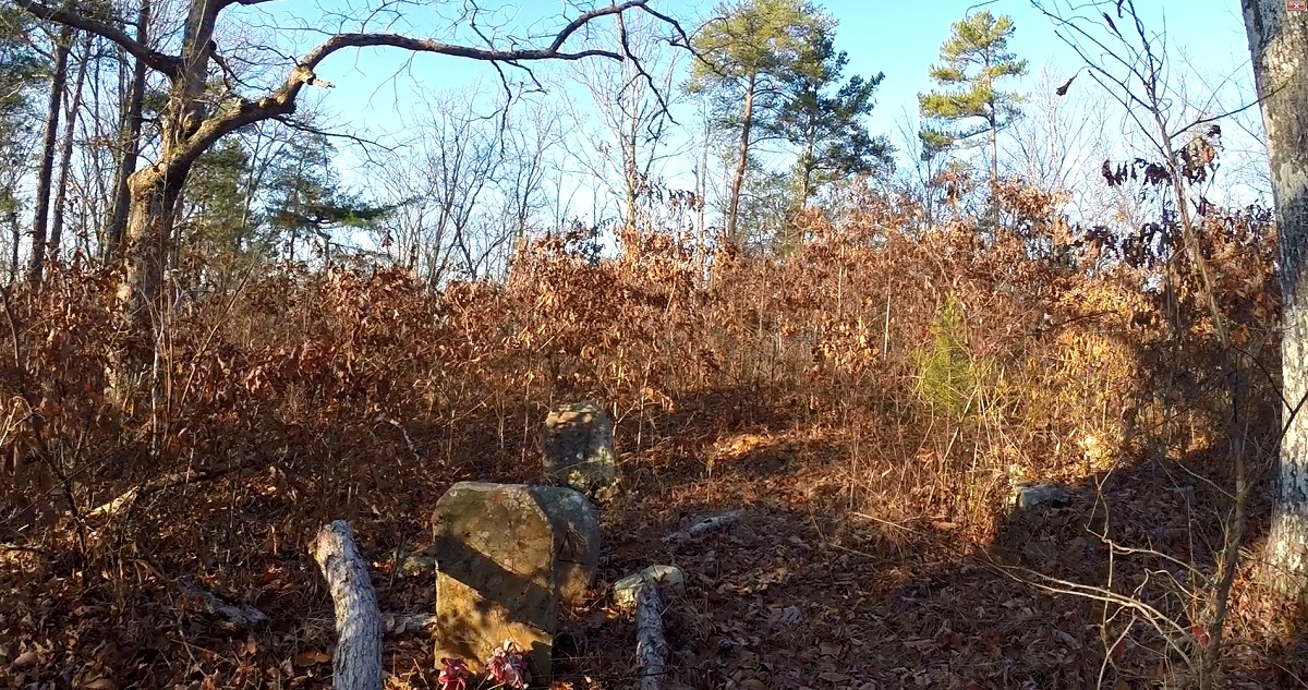
Bell Cemetery
Bell Cemetery rests on a wooded hilltop upon John A. Patten Island. Bell Cemetery was in use in the mid 1800’s. It now lies abandoned. Though I found indications of several grave sites, I only discovered one gravestone. For me, Bell Cemetery is a fine example of a remarkable phenomenon of abandoned cemeteries. There was minuscule evidence of a cemetery being on this land.
In a few more years, all physical indications of this being a cemetery will cease to exist.
Sequoyah Nuclear Power Plant
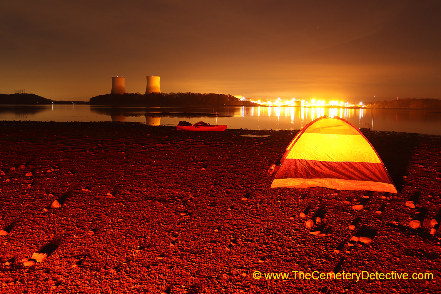
Sequoyah Nuclear Power Plant lies on the Tennessee River approximately at river mile 484. Steam rising from its two cooling towers billow over Skull Island one mile further upriver. Sequoyah first went into operation in 1981. According to TVA’s website, the fission reactor core generates steam that turns a turbine to generate enough electricity to meet the needs of 1.3 million homes in the Tennessee Valley. As I paddle past, I am reminded of a story of two young brothers buried in Skull Island Cemetery.
Skull Island Cemetery
Skull Island comes into sight. Though this island is accessible via roadway, approaching by kayak gives me a better indication of the river’s impact. Grave sites in Skull Island Cemetery were moved here from Norman-Eldridge Cemetery prior to its land’s flooding in 1940 upon the completion of Chickamauga Dam. This cemetery is in disuse and it’s only maintenance is performed by the caretakers of Skull Island or an occasion visit by area school children who take an interest in the property.
Since Skull Island contains a campground, I set up a tent and spend time practicing night time photography and light painting photography shortly after sunset.
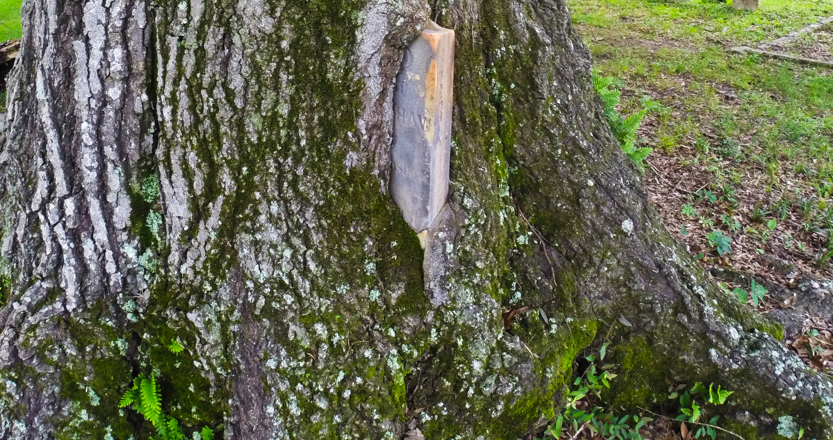
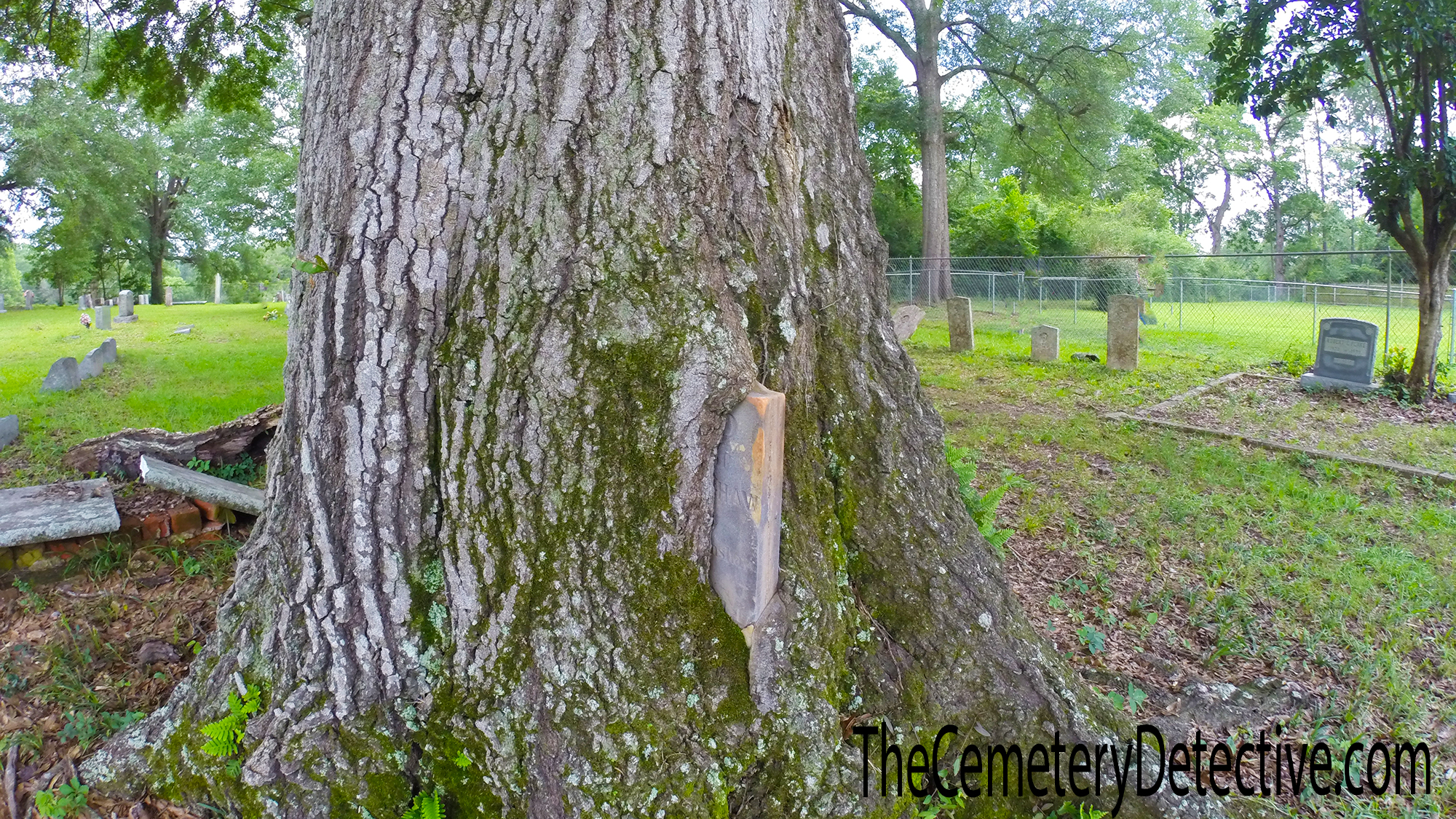
An engulfed gravestone growing into a tree’s trunk.
Gravestone inside Tree
Engulfed Gravestone
This is, perhaps, my favorite picture from a cemetery I visited last June outside Tuscaloosa, Alabama.
I’ve looked at this picture a dozen times. With each viewing, I imagine the slow creep of this tree’s bark. The bark engulfs the gravestone. To me, it signifies the slow creep of time. The slow creep of time that eventually engulfs our life histories. Sure enough, time (the tree’s bark) will eventually complete its encapsulation.
I wonder what will happen if the tree falls one day only to be covered by leaves and mud. Given the correct heat and pressure and moisture, will the tree eventually become petrified wood?
A tree becoming rock.
After dying.
After engulfing a gravestone.
Of a man who died.
After living a full and glorious life.
The tree, which engulfs the gravestone, protects the gravestone for millennia.
The idea gives me chillbumps.
And, then, I look at the picture again. I notice a detail I’ve not seen before in the lower left corner. The fern fronds are SO delicate. So delicate in contrast to the unrelenting force of this gravestone…slowly being engulfed.
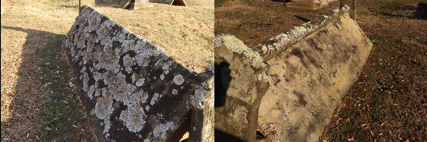
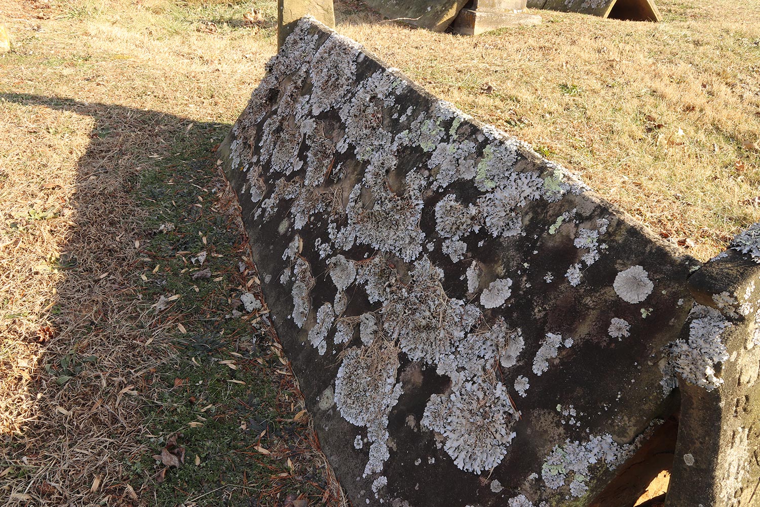
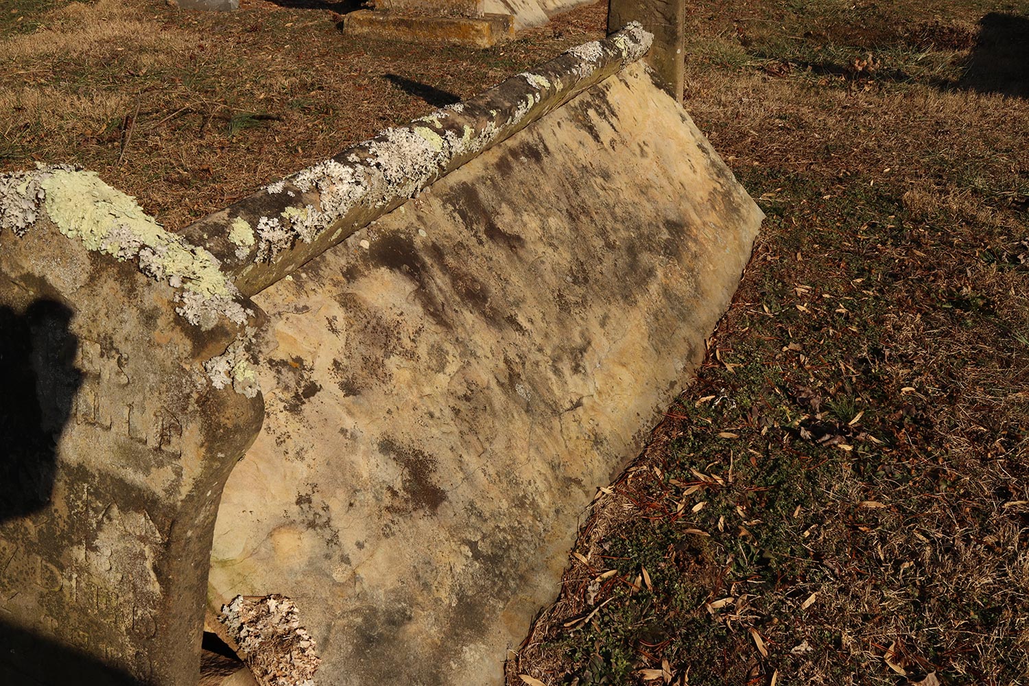
I’m almost embarrassed to admit I’m pretty fascinated with lichen growth on gravestones.
During my visits to study comb graves of the Cumberland Plateau, I encountered quite a few comb graves with West-East orientation. Of course, you would expect this. It is very common for bodies to be buried with their feet toward the East. The reasoning behind this is when the rapture occurs, the body will rise up facing eastward toward the coming of Christ.
Because of this orientation, the right sides face south and the left sides face north. Remember back in elementary school (Boy Scouts and Girl Scouts) when you learned that moss gross on the north sides of trees? The same is sometimes true for gravestones.
You normally don’t see a drastic difference of lichen on the north vs. south side of a gravestone. However, since the roofs of Comb Graves are slanted, the north sides receive quite a bit less sunlight throughout the year allowing lichen to, more readily, grow.
Here is one example of lichen growing on the north side of this comb grave (left) vs. almost no lichen growth on the south (right) side.
2017 was a fantastic year full of cemetery exploration.
2017 was a fantastic year full of cemetery exploration.
Highlights include:
Completing my Submerged Cemetery Documentary
Getting featured in an Adventure Magazine for my Cemetery Research efforts
Traveling to Spain to study the cemeteries in the north of the country.
Other highlights are listed below.
Check my main page to learn about my cemetery research for 2018.
December 2017 – Cemeteries, Cameras, and Flashlights
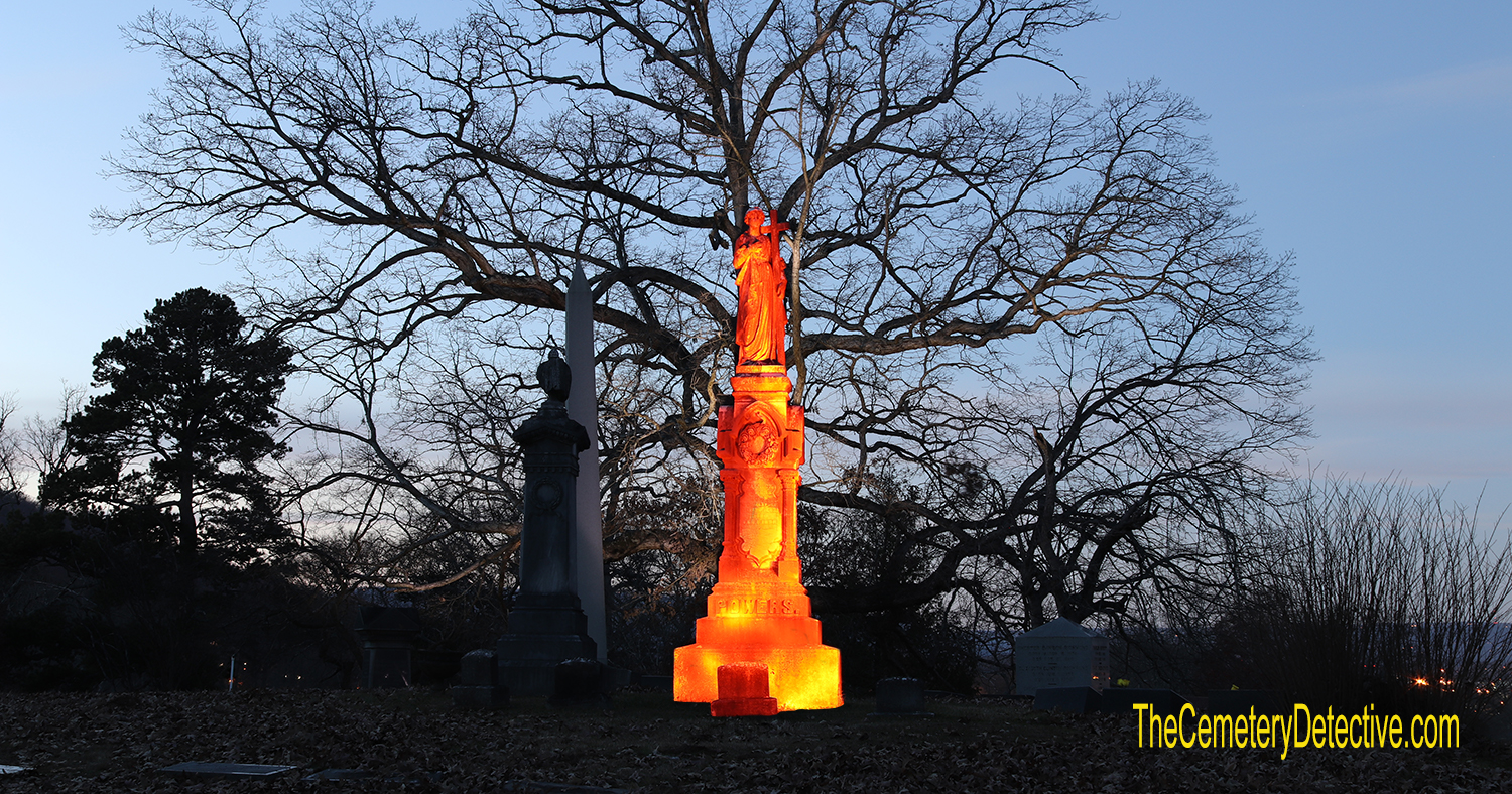
When I was in college, I learned the art of astro-photography and darkroom film development. Being an astronomy geek, I worked at the school’s observatory helping set up the telescope and cameras. Back then, we would spend all night shooting a roll of film then spend the next morning developing the film in light-proof canisters. A lot has changed in the world of photography. Yet, the scientific principles of photography remain the same; aperture, focus (and focal length) ISO, and shutter speed is what it’s all about. Of course, the creative side is another story.
In the month of December, I’ve reawakened my love of photography. Combining photography with my love of cemeteries, I’m working to increase my understanding of creative cemetery photography. Here is a picture I took last night at Chattanooga’s Forest Hills Cemetery. Expect more photography in the coming months.
In addition to cemetery photography, I’ve devoted much of my free time in December to studying cemeteries affected by flood waters both natural and man-made. Here’s an on-location photo from a cemetery I’m researching outside of a nuclear power plant. Expect a brand new Cemetery Detective mini-documentary on this subject in the very near future.
I’d like to take a moment to wish a very Merry Christmas and Happy Holidays to all my readers and fans.
Please check back often. I have a lot of cemetery adventures in store for you in 2018.
My best:
Keith
November 2017 – A Church With A Rock In It
November was such a warm and pleasant month I spent much of it in outdoor pursuits including hiking, biking, and kayaking DeSoto State Park near Mentone, Alabama.
During one of my trips there, I found Sallie Howard Chapel also known as “The Church with a Rock in It.” This chapel was built around a huge boulder jutting into the inside of the church. The boulder acts as the outside wall behind the pulpit.
It’s a fascinating church (with cemetery) and the state park is well worth a visit.
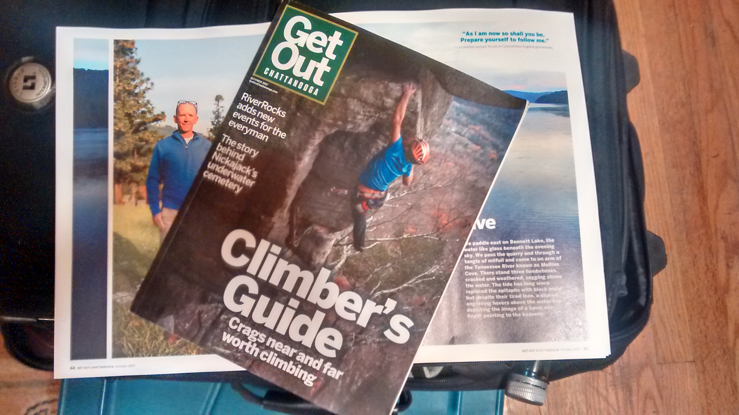
October 2017 – Magazine Articles, Newspaper Write-Ups, and Travel Abroad
October has been one of the most interesting months I’ve had in quite some time.
Points of interest during October:
– Interviewed by The Royal Gazette (Bermuda’s National Newspaper): A reporter saw my video documentary on The Cemeteries of Bermuda.
The newspaper published a newspaper article about my visits to the island.
– Researched the Cemeteries of Northern Spain: After months of planning, I toured the country by train and bus to study the old world European cemeteries of San Sebastian, Pamplona, Figueres, Girona, and Madrid. I will be posting articles in the coming days. Please check back often.
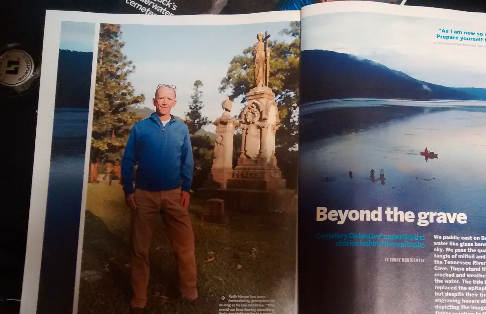
– Featured in an Adventure Magazine: Get Out Chattanooga, our regional Adventure Magazine published a featured article on my research of The Submerged Cemetery at Mullins Cove. I spent a day with a reporter. She interviewed me as we paddled 7 miles round-trip to the submerged cemetery. The article on this particular cemetery was featured in the October Issue.
Check back soon for updates on my cemetery research trip to northern Spain.
September 2017 – A Busy September for The Cemetery Detective
Although summer is not yet over, the beginning of September has brought a respite from the heat. Warmer temperatures will, surely, return. But, for now, I’m enjoying cooler temperatures while exploring our area’s most interesting cemeteries.
At the end of August, I produced a short video dealing with my fascination of Cemetery Fences (linked below). If you enjoy my videos, please consider subscribing to my Cemetery YouTube Channel.
I have several great videos in store for you in the coming weeks including a video documentary of my upcoming Cemetery Research Trip to northern Spain. While in Spain, I will research the cemeteries of The Pyrenees, San Sebastian, and Figueres. If you live in any of those areas of Spain, please drop me a note. I always love meeting fellow cemetery enthusiasts along my journeys.
The Chain Link Fences of Rotten Bayou Cemetery
I had never been a fan of chain link fences in a cemetery….until I visited Rotten Bayou Cemetery in Diamondhead, Mississippi.
August 2017 – Cemetery Documentaries and Continued Research
Sometimes I root through my archives of cemetery pictures, video, and research documentation. After searching through hundreds of folders, I realize I’ve published only a fraction of my archives. This month, I’m pleased to announce the publication of two cemetery documentaries that have been on my mind all summer.
1) The Submerged Cemetery of Mullins Cove
This is one of the most fascinating cemetery stories I’ve ever researched. This cemetery has been affected by rising waters for more than a century. The Submerged Cemetery at Mullins Cove investigates the life histories of Henry, Zilpha, and Moses Long. It explores the topography and geology of Mullins Cove, Tennessee. And, it researches the reasons why this cemetery is underwater.
15 Minutes in Length and PACKED with information.
2) The Cemeteries of St. Thomas, Tortola, Bermuda, and Newport
Earlier this year, I was incredibly fortunate to be invited to work as delivery crew on a 62′ sailboat. We moved the sailboat from Tortola BVI to Portsmouth, RI. On this journey, I added to my list of cemeteries I’ve already visited in these areas.
This Cemetery Documentary chronicles my trip, the excitement of traveling on the open ocean, and the cemeteries I explored along the way.
July 2017 – Upcoming Cemetery Research
It’s been a busy summer thus far.
During June, I attended the Association For Gravestone Studies Annual Conference in Tuscaloosa, Alabama. This was my fourth conference. It is always an uplifting experience being around such knowledgeable and passionate cemetery enthusiasts.
At this conference, I gave a presentation on my research of The Submerged Cemetery At Mullins Cove.
I can spend hours speaking about this cemetery. Its history is fascinating. If your civic group would like me to give this presentation, please visit my “Public Speaking” page for scheduling information.
July is going to be busy, also. I’m putting final touches on a new Cemetery Documentary to be released by mid-month.
Additionally, I’m preparing for a cemetery research trip to Northern Spain in the early fall. I’ll visit the major cemeteries in San Sebastian, Girona, and Madrid. I’m also planning on a tour of cemeteries in the eastern Pyrenees. If you live in that area and are interested in the local cemeteries, I would love to meet you.
I’ll leave you with a couple photographs from my trip in May to the U.S. and British Virgin Islands:
Moravian CemeteryTortola Cemetery
June 2017 – Two Cemetery Projects Underway
Check back often for updates.
1) Underwater Cemetery:
I have become fascinated with cemeteries impacted by water.
Rising waters in rivers, drought stricken lakes, and coastal areas all have affected cemeteries.
I am currently studying a cemetery in the middle of a lake.
This will be the subject of my next mini-documentary and I will also make a presentation on this cemetery during the Association for Gravestone Studies Annual Conference.
If you’re planning on attending the conference, please look me up and say “hi.” I’d love to meet you.
2) Cemetery Reclamation:
I’m writing this at 11:51 PM after yet another long day in one of our local cemeteries.
With a chainsaw, lop-shears, an axe, and a strong back, I’ve taken on a project of reclaiming a long-forgotten cemetery.
When I first visited, I could not walk from one end to the other due to thickets, thorns, and brier patches. Taking care to maintain the integrity of all grave markers, I have almost completed the reclamation effort. Stay tuned to this website and my YouTube channel for a complete update.
This cemetery was completely overgrown but I’m making great progress in finding all headstones by removing the vegetation. When finished, I plan to leave many shade trees. However, the undergrowth will be cut away. Tombstones will be easy to find.
Stay Tuned…
A recent mini-documentary:
The Forgotten Cemetery of Polk County Tennessee
Nestled on a forested hilltop within The Cherokee National Forest lies Rock Creek Cemetery. Even its proper name is in doubt. USGS maps, local residents, and descendants of those buried here disagree on its name. As the forest closes in on Rock Creek, this cemetery risks being lost forever.
The journey is part of the adventure and this trip was no exception. Rock Creek is surrounded by the beauty of the Ocoee river valley. This abandoned grave yard contains notable figures in Polk County’s history. In addition to the town’s founding fathers, a Revolutionary War soldier is buried here.
Join me as I search for this culturally significant cemetery.
Big plans are underway this year. Check this website and my YouTube Channel for frequent updates.
I love feedback. So, please leave your comments and drop me notes when you see something here you like.
What constitutes a cemetery? Do you ever think about the idea of a burying ground that transcends the strict and cultural definition of a traditional cemetery?
A 400 Million Year Old Cemetery?
What constitutes a cemetery? I understand there are legal classifications and procedural definitions. But, do you ever think about the idea of a burying ground that transcends the strict and cultural idea of a traditional cemetery?
Is a pet cemetery actually a cemetery? If humans designate land where they bury their pets, it certainly fits my definition of a cemetery. Is human interaction needed for it to be considered a cemetery? I’ve read about elderly elephants who are aware they are going to die. They migrate to ancient elephant graveyards where their relatives come to mourn their passing. There are no humans to designate this as a cemetery…but the elephants think it’s one. What about pre-historic graveyards; the final resting places of beings that lived millions of years ago? Is it unreasonable to stretch our imaginations by exploring the far reaches of what, actually, constitutes a cemetery?
Sometimes, I enjoy contemplating the actual definition of a cemetery. One of these internal contemplations happened on a trip to explore Cowan Cemetery.
Cowan Cemetery
I recently took a trip to Meigs County, Tennessee to visit Cowan Cemetery. This cemetery dates back to the 1850’s as a cemetery for Cowan family members. There are many fieldstones here denoting unnamed gravesites. A few of the fieldstone markers are hewn into triangular shapes. Though not perfectly angled, they remind me of endstones from tent gravesites found in some Tennessee cemeteries and other cemeteries in the southeast. One grave marker displays fantastic “Hand of God” symbology. The hand, clutching lilies and roses, is downward facing with an outstretched pointing index finger.
Cowan Cemetery is a short paddle away from an area known as Rattlesnake Point. Rattlesnake Point is where my Father’s family used to hold their yearly family reunions on the banks of the Hiwassee River. The Hiwassee River is a tributary of the Tennessee River. Its unique geology makes for joyful fossil hunting. I spent those family reunions searching for fossils on the banks of the Hiwassee river. I clearly remember the first time I found a fossil. Though my family wasn’t at all interested in my explorations, I fantasized that I would be recognized as a great dinosaur fossil hunter by the scientific community.
Fossilized Rock
In reality, the fossil I found wasn’t from the Dinosaur era. Instead, it was filled with Brachiopod fossils from the Devonian period. This geological period dates back 400 million years; long before Dinosaurs appeared on earth.
I often think back to my first fossil find and its influence on my interest in cemeteries. When you think about it, that rock is similar to a cemetery in that it is the final resting place for hundreds of beings. It’s kind of like a cemetery; a 400 million year old Brachiopod cemetery.