Documenting Forest Hills Cemetery (Chattanooga, TN)

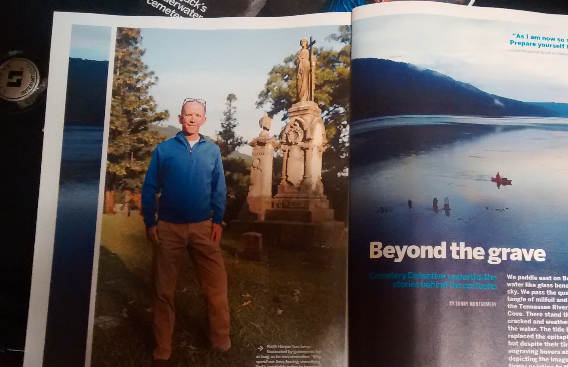
By The Cemetery Detective — Forest Hills Cemetery, St. Elmo / Lookout Mountain foothills (2025 visit)

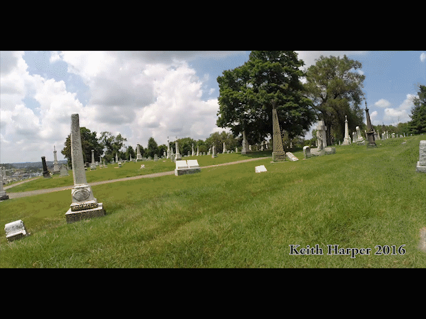
Forest Hills Cemetery is one of Chattanooga’s oldest and most historically layered burial grounds. Forest Hills was established in 1880, sitting at the foot of Lookout Mountain, and serving generations of local families, veterans (including Civil War interments), and the city’s industrial communities. The cemetery is large (roughly 100 acres with tens of thousands of recorded burials), contains distinctive historic monuments (including a prominent Confederate memorial), and has a documented map maintained by the Forest Hills Cemetery Association. All of these are reasons why a careful, repeatable program of temporal and geospatial documentation is valuable.

Below I describe the independent work I performed at Forest Hills, the same two-part approach I use at other sites: (A) temporal documentation (video with meta timestamps) and (B) spatial precision (GPS tracklog). Then I expand on how I prescribe to use GIS to build layers that make the cemetery data queryable, searchable, and useful for specialized research (for example: mapping all marble stones, all granite monuments, and locating zinc markers).


Why Forest Hills Benefits from this Approach

Forest Hills is a historic community cemetery serving people tied to Chattanooga’s growth. Miners, railroad and ironworkers, Reconstruction-era families, fraternal organizations, and local civic leaders have all been served by Forest Hills Cemetery. Its location near Lookout Mountain and the St. Elmo neighborhood gives it both scenic and historical significance. The scale of the site and the importance of certain monuments mean that a year-by-year visual record plus geospatial layers give historians, genealogists, and municipal stewards a repeatable way to answer questions like: where are all of the Civil War veteran graves, which areas show accelerated stone weathering, or which lots contain zinc markers that are prone to a distinct corrosion pattern.


Temporal Documentation: video drive-throughs and targeted still photography

My video drive-through captures the roads and lanes as a continuous, date-stamped visual record. For Forest Hills I did:

  • A slow drive covering primary loops and secondary lanes, filmed at 1080p+ with steady mounting and embedded time-calls at the start and end of each pass.
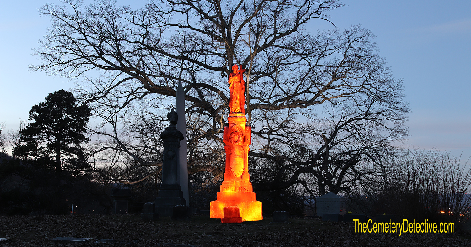
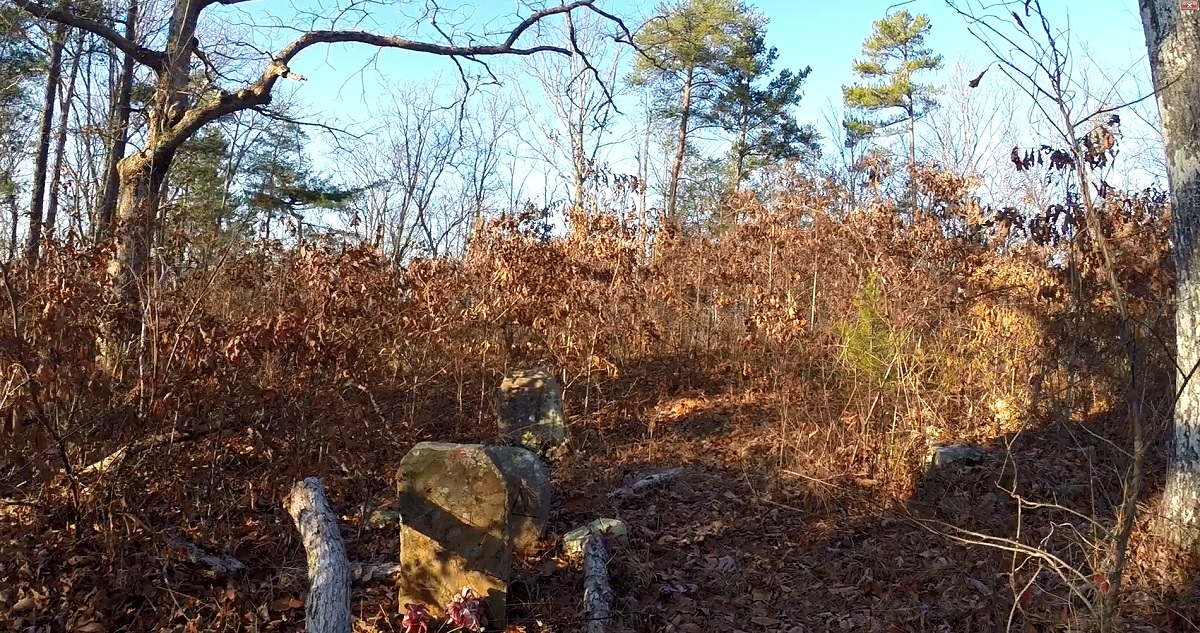
  • Walk-and-shoot segments for notable monuments: the Confederate monument, large marble angels and sculpted figures, mausolea, and any zinc (white-metal) markers I could find. Photographs of inscriptions were captured at high resolution for later transcription. (Zinc markers stand out visually and require different conservation attention than granite or marble.)

Why video + close photos? Video records context of tree cover, sightlines, road surfaces, decorations, and temporary items while still photos capture legible inscriptions and fine detail for transcription and material identification.


Spatial documentation: GPS logging and GIS-ready GPX files

Simultaneously with the video I logged the drive routes using a high-accuracy GPS datalogger (1–5 second sampling). I export GPX tracks and bring them into GIS software (QGIS/ArcGIS). These GPX polylines form the skeleton I use to anchor video timestamps to exact map locations. These datapoints enable a researcher to jump from a map coordinate to the corresponding moment in the video.

I also collect single-point GPS fixes for specific features (e.g., unusual monuments, zinc markers, mausolea, cemetery sign). Each point is given a unique ID and linked to high-resolution photos and a short descriptive note (material, inscription legibility, condition).

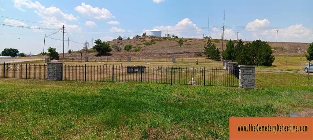
Forest Hills maintains an official map and burial records which I use as a reference layer when positioning my features within the cemetery’s section/lot grid.


Building GIS Layers: a reproducible, queryable data model

The value of GIS is not just a pretty map. GIS’ beauty comes from its ability to store attributes and filter/query them. Cemeteries like Forest Hills, benefit from maintaining core layers:

  1. Base layers
    • High-resolution orthophoto (if available), or current aerial basemap.
    • Cemetery property boundary and scanned official map (georeferenced PDF).
  2. Road & Pathway polylines
    • Created from GPX tracks; each polyline has attributes: road_name, drive_direction, record_date, video_file, video_start_time, video_end_time.
  3. Plot/Section grid (vector polygons)
    • Digitized from the cemetery’s official map and/or from on-the-ground GPS corner points. Attributes: section, lot, availability, notes.
  4. Monument points (the key research layer)
    • One point per monument/marker with attributes such as:
      • feature_ID (unique)name_on_marker (if legible)primary_material (marble, granite, limestone, zinc, bronze, concrete, etc.)secondary_material (base/ornament)marker_type (upright, flat, ledger, obelisk, mausoleum, zinc_tablet)date_erected (if inscribed)inscription_text (full or partial transcription)condition_score (numeric or categorical — e.g., 1–5)photo_refs (filenames, with timestamp)GPS_accuracy and recorded_by metadata
    This layer is what lets us answer queries like “show me all marble markers,” or “select all zinc markers installed before 1910.” Mapping material is essential to studies in cemetery geology and conservation because materials weather differently and tell us about sourcing and local trade patterns. (In Forest Hills marble appears commonly on older monuments; zinc monuments are less common but highly distinctive.)
  5. Zinc markers — an explicit sub-layer
    • I often create a zinc feature class (or a boolean field is_zinc) because zinc monuments (a.k.a. “white bronze”) were popular 1870–1920 and have specific conservation and provenance stories. Zinc’s patina and brittle mounting methods make them a separate conservation case. Treating them as a distinct layer makes preservation tracking straightforward. (Readers of Forest Hills note a singular or small number of zinc markers among the granite and marble landscape.)
  6. Vegetation & tree canopy
    • Large trees can obscure inscriptions, damage stones through root action, or alter microclimates that accelerate biological growth on stone. I map specimen trees and canopy cover where relevant to monument condition assessments.
  7. Historic overlays
    • Georeferenced historical maps, insurance plat maps, city directories, and old aerials. These let one detect reinterments, landscape changes, or realignments. Forest Hills’s long history and the movement of some graves across the city is why historical overlays are useful.

Example GIS queries and analyses you can do once layers exist

  • “Select all monuments where primary_material = 'marble' and date_erected < 1920” — to study Victorian marble weathering patterns.
  • “Map all is_zinc = TRUE points and buffer 1 meter to assess mounting/settlement issues.”
  • “Join the monument layer to burial registry tables by name_on_marker and burial_date to create a searchable, name-indexed map.”
  • “Temporal change detection: overlay photos from 2015, 2020, 2025 to automatically flag monuments with new tilt/fallen status.”
  • “Slope/DEM analysis: identify plot areas with slope > X degrees where erosion or soil movement threatens stones.”

Practical GIS tips & file management

  • Coordinate Reference System (CRS): capture GPS in WGS84 (EPSG:4326), but store and perform local spatial analysis in an appropriate projected CRS for Tennessee (e.g., NAD83 / Tennessee State Plane or UTM zone that minimizes distortion) when you need accurate area/length measurements.
  • Attribute templates: use consistent field names (snake_case or camelCase) and controlled vocabularies (e.g., a fixed list of materials) to keep queries reliable.
  • Photo & video linking: store media files with filename conventions that match feature_ID or include timestamps; keep a CSV or GeoPackage attribute that lists the media filenames so a map click can open the photo or jump to the time in the drive-through video.
  • Backups: keep raw video and original GPX tracks (uncompressed where possible) and create web-friendly derivatives (MP4, simplified GeoJSON/GPX) for publication.
  • Public export: consider publishing a sequence of KMZ/GeoJSON files and a CSV index for other researchers along with the site’s permission.

Forest Hills Cemetery: communities and industrial past visible in stone

Walking Forest Hills, you’ll see the social layering in funerary art:

  • Veterans’ memorials: there are many veteran markers.
  • Industrial families & fraternal stones: the rise of Chattanooga’s manufacturing and rail era is reflected in obelisks, ledger-style stones for prominent families, and many fraternal emblems (Masonic, Woodmen of the World). The materials chosen, often marble for 19th-century Victorian markers and granite later, echo the economics of the era and local stone/transport availability.
  • Ethnic and community histories: Forest Hills contains burials from across Chattanooga’s social history, including Reconstruction-era African American sections that document once-segregated burial practices. Such patterns should be recorded sensitively and with reference to local office records.

Mapping these social layers by veteran status, fraternal membership, material type, and erecting date lets researchers visualize how the community’s funerary landscape reflects Chattanooga’s industrial and social history.


Why publish this work on TheCemeteryDetective.com?

A well-organized public archive (video + map + downloadable GPX/GeoJSON + searchable CSV of monuments) does three things:

  1. Preserves a temporal snapshot (how Forest Hills looked in 2025).
  2. Provides spatially precise references for genealogists and conservators.
  3. Enables research queries (e.g., find all zinc markers, list all marble markers erected before 1900, or show areas where canopy cover may be harming stones).

Forest Hills Cemetery, given its founding date, scale, and visible memorial types, is particularly well-suited to this kind of combined preservation work.

Demonstrating what is Possible

A full-scale Temporal and Geospatial Documentation project requires a significant commitment of resources and coordination from cemetery management. My visit to Forest Hills Cemetery in Chattanooga represents a focused effort to demonstrate what is possible when technology and historical preservation meet. During my time in Forest Hills, I recorded a complete visual record using a roof-mounted GoPro camera while simultaneously capturing temporal and geospatial data via GPS. Together, these data form a lasting digital archive. It is a snapshot (video) of the cemetery’s layout, demography, and pathways as they exist today. In the years to come, as landscapes evolve and headstones weather, this record will stand as a vital reference point for researchers, genealogists, and future caretakers dedicated to preserving the memory and material heritage within Forest Hills Cemetery.

References:
Find A GraveForest Hills Cemetery in Chattanooga, TennesseeLocated in St. Elmo at the foot of Lookout Mountain, Forest Hills Cemetery was established in 1880 by a group led by Colonel Abraham Malone Johnson.

taphotourist.comForest Hills Cemetery by The TaphotouristForest Hill’s historical graves boast scores of Civil War veterans, industrialists, Reconstruction Era African Americans (when graves were still segregated – a …

thecemeterytraveler.blogspot.comChattanooga and Forest Hills CemeteryJul 17, 2015 — There was the singular large zinc monument among the granite and marble. There were twin, life-sized marble angels flanking a giant column.

foresthillscemetery.netScanned Document – Forest Hills CemeteryMAP OF. FOREST HILLS CEMETERY. PROPERTY OF. FOREST HILLS CEMETERY ASSOCIATION. CHATTANOOGA TENNESSEE … www.foresthillscemetery.net.

foresthillscemetery.netForest Hills Cemetery – ChattanoogaLocated in St. Elmo at the foot of Lookout Mountain, Forest Hills Cemetery was established in 1880 by a group led by Colonel Abraham Malone Johnson. Forest …

adventuresincemeteryhopping.comTaking a Spring Stroll in Chattanooga’s Forest Hills …Jun 7, 2019 — Rare White Bronze Marker. The last marker I wanted to talk about is this white bronze (zinc) one, a rarity in a Southern cemetery. Finding …

adventuresincemeteryhopping.comJune | 2019 | Adventures in Cemetery …Jun 14, 2019 — It’s called Guess Who’s in the Mausoleum. While doing research on Forest Hills Cemetery’s mausoleums, I found myself eye-deep in this game.

thecemeterydetective.comForest Hills Cemetery – Chattanooga, TennesseeApr 2, 2014 — Monument at Forest Hills Cemetery – Chattanooga, Tennessee Forest Hills Monument … – A Zinc Grave Marker! Florence City Cemetery – YOU WON’T RUN …

thecemeterydetective.comCemetery Discoveries – Page 8 of 11Nestled within the Lookout Mountain foothills, Forest Hills Cemetery is easily one of the most interesting cemeteries in Chattanooga, Tennessee. Whenever I am …

tngenweb.orgForest Hills CemeteryForest Hills Cemetery was founded in 1880 and is in use to the present day. It covers approximately 100 acres. It has over 43,000 recorded burials with space …

tngenweb.orgForest Hills Cemetery, Hamilton Co. TNMar 1, 2008 — Longitude, -85.323013. Elevation, 715. USGS map, Chattanooga. Location, 4016 Tennessee Ave., Chattanooga. Recorder. Access. Upkeep. Size. Survey …

tngenweb.orgForest Hills CemeteryMar 25, 2006 — Forest Hills Cemetery is three miles south of Chattanooga at the foot of Lookout Mountain. It was incorporated in 1885 by the late Col. AM Johnson.

mapquest.comForest Hills Cemetery, 4016 Tennessee Ave, Chattanooga …Get more information for Forest Hills Cemetery in Chattanooga, TN. See reviews, map, get the address, and find directions.

findagrave.comForest Hills Cemetery (Chattanooga, TN)Forest Hills Cemetery. Chattanooga, Hamilton County, Tennessee, USA. Plot info: Section P, Lot 175. Lena Laurens Ferguson Freeman Flowers have been left.

waze.comDriving directions to Forest Hills Cemetery, 4016 …4016 Tennessee Ave, Chattanooga, Tennessee, United States. Open in Waze. (423) 821-4161 · foresthillscemetery.net. Closed now. Sunday08:00 – 18:00.

causeiq.comForest Hills Cemetery Association | Chattanooga, TNAddress: 4016 Tennessee Ave: Chattanooga, TN 37409 ; Metro area: Chattanooga, TN-GA ; County: Hamilton County, TN ; Website URL: foresthillscemetery.net/ ; Phone: ( …

tripadvisor.comForest Hills Cemetery, ChattanoogaForest Hills Cemetery is a very large cemetery located near the bottom of Lookout Mountain in the St. Elmo neighborhood district.

wikitree.comCategory: Forest Hills Cemetery, Chattanooga, TennesseeJan 1, 2023 — Name: Forest Hills Cemetery. Location: Category: Chattanooga, Tennessee. Address: 4016 Tennessee Avenue, Chattanooga, Tennessee, 37409.

Documenting Ishpeming Cemetery: why a drive through and GPX tracks matter

By The Cemetery Detective — Ishpeming, Michigan (2025 visit)

Ishpeming Cemetery sits on a gentle hill above Deer Lake Avenue in Ishpeming, Michigan. It’s a municipal cemetery with an extensive set of burial records, a mapped layout, and a long local history. This history includes the relocation of older graves from an earlier town burying ground in the late 1800s. Because of that layering of sites, re-interments, and shifting pathways, a good modern documentation record is especially valuable for historians, genealogists, and municipal preservation efforts. ishpemingcity.org+2ishpemingcity.org+2

Cemetery Documentation

During my recent trip I recorded a full “drive-through” video of the roadway network inside Ishpeming Cemetery. A video drive-through captures a continuous, human-scale view of every gravestone, fence, tree, sign, and pathway as they appear from the roads at the moment of recording. That single camera run becomes a fixed timestamp. Future researchers can see what a particular plot, marker, or avenue looked like in 2025.

Why that matters for Ishpeming in particular

  • The City of Ishpeming maintains burial records going back to the 1890s and publishes maps and a cemetery ordinance. But maps and lists don’t fully convey what a space feels like or how vegetation, monuments, and road surfaces appear at a moment in time. The city’s cemetery office is a great place to start if you need interment records or plot layout. ishpemingcity.org+1
  • Ishpeming’s earlier burying ground (near North, Pine and Maple Streets) was cleared and many remains were moved to the present site on Deer Lake Avenue between 1905 and 1911; that history makes a living photographic/film record valuable for tracing which markers and landscape features are original and which reflect later re-interment or landscaping. miningjournal.net

Video + GPS: a two-part preservation approach
Video alone is excellent for visual context, but it lacks precise spatial coordinates. That’s where GPS comes in. During my drive-through I also logged the roadway with a datalogger and exported the resulting GPX file into GIS software. Combining the two gives us:

  1. Temporal evidence (video): what each marker and roadway looked like in 2025 To the best of the video’s ability, wear, inscriptions, vegetation, signage, and temporary features (flags, decorations, construction cones) are recorded.
  2. Spatial precision (GPX → GIS): meter-level accurate polylines for the cemetery roads so the video frames can be tied to exact map locations, enabling future researchers to jump to locations in both the map and the video. (Ishpeming Cemetery’s coordinates place it in Marquette County; the site is documented in public place name databases.) TopoQuest+1

Processing Cemetery Data

How I process and store the data (practical steps you can reuse)

  • Video capture: steady dash or handheld camera, 1080p or higher, set to record continuously during the roadway pass. Note start/stop times precisely and say the start time out loud into the camera that audio timestamp helps later synchronization.
  • GPS log: run a dedicated datalogger or a smartphone app that records GPX tracks sampling at 1–5 second intervals. A dedicated external GPS (with WAAS/EGNOS enabled) will gives better positional accuracy than my phone.
  • File naming & metadata: name files with cemetery name, date (YYYYMMDD), device ID, and direction (e.g., IshpemingCemetery_20250512_dash_roadA_EW.mp4 and IshpemingCemetery_20250512_dash_roadA.gpx). In the video’s metadata or a separate text file, note weather, vehicle speed, and any interruptions.
  • GIS import: import the GPX into QGIS or ArcGIS as a track and convert those tracks to polylines representing each roadway. Use the cemetery’s official map (the City of Ishpeming publishes one) to reference section names/plot grids.
  • Syncing video to map: either slice the video into short clips tied to road segments and reference them in attribute tables, or keep one continuous video and store timestamps for notable markers. For an indexed archive, create a spreadsheet (or a GeoPackage attribute table) with columns: file, start_time, end_time, GPX_segment_ID, feature_notes, photo_refs.
  • Backups & formats: keep originals in uncompressed or high-quality formats and create web-friendly MP4s for publishing. Store everything in at least two locations (local SSD + cloud vault).

Future Use of Cemetery Documentation

Examples of research uses

  • Genealogists tracing families recorded in the city’s burial index can match names to visible monuments in the 2025 video and confirm inscriptions and monument types. Ishpeming has thousands of memorial records online (for example, Find A Grave lists many memorials for this cemetery), making a combined visual + spatial archive extremely useful. Find a Grave+1
  • Preservationists can compare year-to-year videos to detect new damage (fallen markers, vandalism), landscape changes, or road realignment.
  • Municipal staff and historians can reference the footage during repair or relocation work (remember the major reinterments from the early 1900s — misplaced or missing Potter’s Field graves were historically an issue). miningjournal.net

A few “Cemetery Detective Quick Tips” when filming in cemeteries

  • Be respectful: follow posted rules (Ishpeming Cemetery posts hours and site rules).
  • Slow and steady wins: drive slowly and keep motion smooth so to reduce blurriness of headstone images.
  • Capture the sign(s): a clear shot of the cemetery sign and any dated plaques helps future viewers instantly confirm place and policy context. (Ishpeming’s entrance signage is distinctive and useful for this.)

Where to get official records for Ishpeming Cemetery
If you want burial records, maps, or to ask about historic reinterments, contact the Ishpeming Cemetery/DPW office. The city publishes burial records and a cemetery map online and provides contact details for records requests. That’s also the proper channel for asking about permissions if you plan to do comprehensive documentation. ishpemingcity.org+1

Why I publish these archives on TheCemeteryDetective.com
Cemeteries are living history: monuments, plantings, and even road alignments change. A public, well-indexed archive (video + GPX + metadata + city record references) preserves how a place looked and functioned in a year. These act as snapshots that future researchers, family members, and municipal stewards will thank us for. For Ishpeming, with its deep mining-era roots and reinterment history, these snapshots help link names on paper to stones in the ground and to the landscape in between. miningjournal.net+1

References:

billiongraves.comOlga Olgren – BillionGraves GPS HeadstonesAccess burial information, GPS coordinates, and family connections. Gravestone commemorating Olga Olgren

facebook.comIshpeming MI – Cemetery (Dates later than 1900 blacked …Jun 5, 2025 — The first recorded burial at the Catholic Cemetery in Ishpeming was on May 3, 1871, being that of Martin Wall. The last burial was of Joseph …

facebook.comIshpeming Area Historical Society & MuseumPlease mark your calendar with the dates for the 2026 Ishpeming Cemetery Tour which will lift up the memory of the miners who were killed in the Barnes-Hecker …

facebook.comTiny cemetery near Montague, Michigan with famous graveNear the town of Montague, Michigan you will find this tiny cemetery. There is 17 graves listed and one who is kind of famous.

facebook.comThe Ishpeming cemetery is open to Residents and nonThe Ishpeming cemetery is open to Residents and non-residents alike. Burial plots can be purchased now with group discounts available.

mapquest.comIshpeming Cemetery, Deer Lake Rd …Get more information for Ishpeming Cemetery in Ishpeming, MI. See reviews, map, get the address, and find directions.

uppermichiganssource.comWorld War I remembered at Ishpeming CemeteryJul 9, 2017 — History enthusiasts had a chance to learn more about World War 1 Sunday afternoon at the Ishpeming Cemetery.

ishpemingcity.orgCemetery MapIshpeming Cemetery Map. Phone: (906)485-1091 • Fax: (906)485-6246 • City Hall: 100 E. Division Street, Ishpeming, MI 49849

findagrave.comIshpeming CemeteryAndrew Anderson Flowers have been left. Memorial ID. 28 Dec 1885 – 15 Mar 1933. Andrew Anderson was born June 4,1886 in Ishpeming…

findagrave.comCemeteries in Ishpeming, Michigan3 cemeteries in Ishpeming, Michigan. Barnes -Hecker Mine Memorial · Ishpeming Cemetery … cemeteries found in Ishpeming, Michigan will be saved to your photo …

findagrave.comBarnes -Hecker Mine Memorial in Ishpeming, MichiganJan 14, 2018 — 1137-2939 County Road Cl Ishpeming, Michigan 49849 United States Coordinates: 46.50309, -87.77913 Members have Contributed About these numbers

ishpeminghistory.orgIshpeming Timeline1967 – Cliffs Shaft Mine ceased operation. 1970 – The population of Ishpeming was 8,245 1973 – Cliffs Shaft Mine was designated a state of Michigan historic …

coordinatesfinder.comGPS coordinates for Ishpeming MichiganGPS coordinates for Ishpeming Michigan · Latitude: 46.4885469. Longitude: -87.6676358 · More coordinates for Ishpeming Michigan · Extra information about Ishpeming …

coordinatesfinder.comGPS coordinates for ISHPEMING, MIGPS coordinates for ISHPEMING, MI · Latitude: 46.488547. Longitude: -87.667636 · More coordinates for ISHPEMING, MI · Extra information about ISHPEMING, MI.

michigangravestones.orgIshpeming Cemetery – Marquette County, MichiganBurials in Ishpeming Cemetery, Marquette County, Michigan. Find genealogy and surname records in Marquette County, Michigan.

bjorkandzhulkie.comObituary | Anthony Donato Gagliardi of Ishpeming, MichiganMar 29, 2018 — A private family burial will take place at the Ishpeming Cemetery following the funeral luncheon. The family requests, due to allergies …

youtube.comIshpeming Area Historical Society Cemetery Tour Returns For …ISHPEMING, Mich – A local cemetery tour is returning this August. The Ishpeming Area Historical Society Cemetery Tour will take place every …

expertgps.comMap and Download 3398 Cemeteries in Michigan to your …Map and Download GPS Waypoints for 3398 Cemeteries in Michigan. Click here … Ishpeming Cemetery; Additional Cemeteries in Nearby Towns: Negaunee, Ely …

waltersfamilytree.netIshpeming Cemetery, Ishpeming, Marquette, Michigan, USAIshpeming Cemetery, Ishpeming, Marquette, Michigan, USA: Walters Family Tree. … Cemetery Records · Census Records · Church Photos · City Directories · Civil War …

genealogybuff.comMarquette County, Michigan Obituary Collection – 45Jun 16, 2011 — Burial will be in the Skandia Lutheran Cemetery, with Russell Westman, Dan Johnson, Brian Weatherdon, David Lehtinen, Mark Anderson and Al …

billiongraves.comIshpeming CemeteryLoading Cemetery…

Crisis in the Early Days of Greenwood Cemetery – Petoskey, Michigan

00:00 Introduction to Greenwood Cemetery
00:30 Introduction to Petoskey, Michigan
01:00 Mission Statement
01:30 Birth of Petoskey, Michigan
01:45 Size and Scope of Greenwood Cemetery
05:00 History of Petoskey, Michigan
06:00 The Need for a City Cemetery in Petoskey
08:00 Pandemic and World War I
14:00 Community Identity through its Cemetery

This video provides an overview of both the Greenwood Cemetery in Petoskey, Michigan, and the early history of Petoskey City itself.

The documents related to Greenwood Cemetery, a perpetual care municipal cemetery, detail its history, arboretum status, staff, and essential information like burial options and contact details, while the visitor guide outlines rules for guests concerning hours, respecting the peace, and pet guidelines.

Separately, an article from 1921 recounts the founding and growth of Petoskey beginning in 1873, focusing on its initial development around the railroad, including the first structures, settlers, and the influence of the local Ottawa tribe.

Collectively, this video looks at both a significant contemporary landmark and the historical origins of the surrounding area.

References:
https://www.TheCemeteryDetective
https://www.gwood.us/
https://www.gwood.us/visitor-guide
https://gwoodazure.blob.core.windows…. https://gwoodazure.blob.core.windows….

A Modern Walk Among the Tombs in the Spirit of Muir at Bonaventure Cemetery

By Keith Harper – The Cemetery Detective

After weeks of slow travel through the Southern lowlands, I arrived at Bonaventure Cemetery by way of the old river road, winding along the fringes of Savannah, Georgia. 

My car, a modified 2015 Honda Accord that I have come to call the Hondaminium, carried all my necessary provisions: sleeping platform, boots, books, kayak strapped on top, a notebook of my geological field drawings, and a laptop computer filled with video and photos and GIS Maps from my prior cemeteries. It is a humble vessel, but it has taken me across this continent and into the quiet corners where stone and memory meet.

In no way would I ever compare my wanderings to those of John Muir, but in some ways, he inspires the paths I take. John Muir was a great naturalist and founder of the Sierra Club. He was not just a mountaineer of the western ranges but a wandering philosopher of the American landscape. In 1867, after a factory accident left him temporarily blind, he set off on foot from Indiana to the Gulf of Mexico, seeking healing in the wild. With a handmade plant press and a tattered copy of Paradise Lost, he walked over 1,000 miles alone, penniless, often sleeping beneath trees or in abandoned cabins. His journal from that journey, later published as A Thousand-Mile Walk to the Gulf, is a blend of scientific observation, spiritual reflection, and poetic wonder. One chapter, “Camping Among the Tombs,” describes six nights he spent in Bonaventure Cemetery, then a largely forgotten tract of live oaks and old gravestones on the edge of Savannah. Far from finding it morbid or melancholy, Muir saw in Bonaventure a sublime harmony between life and death, nature and memory. It is this chapter, and that sense of reverent curiosity, that I carried with me on my own visit.

I arrived at Bonaventure Cemetery on a warm, still morning. The air tasted faintly of salt and pine. Great arms of live oak stretched over the road, their limbs clothed in Spanish moss and resurrection ferns. I passed ragged fields, broken fences, and a series of stilt-legged cottages near the water. Just beyond, the forest seemed to open, and I knew I had arrived.

The gates of Bonaventure stood solemn yet inviting. I parked beneath a canopy of green and began my walk.

The ground was soft and littered with pine needles and camellia petals. Oaks, magnolias, and palmettos formed groves around the family plots, their trunks straight and noble as stone columns. Muir once wrote, “One can hardly think of another place where the natural and the supernatural seem so lovingly entwined.” I found it to be just so. Nature was not in conflict with the dead here; it walked hand in hand with them.

I wandered slowly, as I always do in these places, letting my attention fall equally on the botanical and the sepulchral. My interest in graveyards is not born of morbidity, but of inquiry. I am a student of geology by inclination, and of cemeteries by profession. I believe every gravestone tells a dual story; one of the person it memorializes, and another of the earth it was carved from.

Many of the oldest monuments in Bonaventure are made of marble, that metamorphic product of pressure and time, beloved by sculptors for its softness and by mourners for its elegance. But marble is a delicate stone in humid air. Acid rain and salt drift from the river cause it to sugar breaking it down into powdery grains that slough away with the years. As I examined a white marble headstone adorned with an angel now almost faceless, I saw the inscription was worn smooth. Only the outline of the angel’s wing remained to hint at the stonecutter’s intent. A slow and silent erosion, like memory fading.

Farther along I found granite markers, darker and more stoic. Their inscriptions were sharp still with biotite and quartz reflecting the midmorning light. Granite does not sugar, though it may crack. It is igneous, born of ancient heat and cooling deep within the crust. These stones, quarried in Georgia or Vermont or sometimes as far away as India, will likely outlast the names they carry.

Each monument I came upon presented a different combination of material and meaning. A column broken midway to symbolize a life cut short. A weeping willow carved in relief upon slate. A clasped hand, the fingers gently parting. These symbols are not idle ornaments, they are languages I strive to interpret, which still speak for those long gone.

Bonaventure is not a place of fear. It is a place of stillness and story. As Muir observed in his own visit here over 150 years ago, “the few graves are low and in no way interrupt the general flow of the forest floor.” Life persists. Resurrection ferns curl and unfurl on tree limbs. Mockingbirds call from the thickets. The dead rest not beneath but within the rhythm of the landscape.

At one quiet bend in the path, I stopped and stood for a long time, staring into a dense pocket of shrubbery beyond a weathered family plot. The sun filtered in through the moss, and for a moment, the cemetery fell utterly silent. I imagined Muir here, weary from the road, swatting at mosquitoes, settling down amid the roots and stones. He wrote that he chose Bonaventure as a place to sleep because it was safer than the surrounding wilderness, yet awoke to find his head resting on a freshly dug grave. The image clung to me. As I stood among the brush, I could almost see him lying there, curled among the palmettos, journal clutched to his chest.

Later that afternoon, I unstrapped my kayak from the roof of the Hondaminium and carried it down to the nearby water’s edge. I paddled through narrow inlets where cypress knees broke the water’s surface and egrets stalked the reeds. The Wilmington River, wide and flat, moved lazily past the cemetery’s bluff. I drifted beneath the very trees I had stood among that morning, their roots braced in mud, their limbs catching wind and whisper.

It felt right to trace the edge of the graveyard by water. Water, like time, wears down even the hardest stone. And like grief, it cannot be held still.

That night, I returned to my car. I prepared a modest supper from my cooler and reclined the seat to re-read John Muir’s chapter by headlamp. I thought of Muir sleeping among the tombs, wrapped in the scent of earth and fallen leaves. I could not bring myself to unroll my bedroll within the cemetery gates because the times and laws are different now, but I car-camped nearby, safe in my Hondaminium tucked beneath an oak on a tree-lined street. As I unfolded my mattress on my sleeping platform with my head resting cozily on a soft, cool pillow, I thought about Muir resting his head on a freshly dug grave, and in spirit I shared the same peace as John did.

Bonaventure had given me what it had given Muir: a quiet place to study, to wonder, and to reconnect with the simple fact that we, too, will return to the elements from which we came. Stone, soil, water, breath.

In the morning, I walked once more beneath the arching oaks, their limbs still heavy with moss and memory. I took no souvenirs, only notes and a few final photographs, though none could capture what lingered in the air. My footprints, soft upon the pine needles, were soon erased by the breeze. The cemetery remained as I had found it: solemn, sun-dappled, and quietly alive. As I turned back toward the road, I thought of Muir rising from his earthen bed, brushing off the dew, and continuing his thousand-mile walk. I had come by car, not by foot, and stayed just a short while, yet I, too, left changed. In Bonaventure, among the tombs and trees, we had both found something enduring; not death, but the echo of life, layered in stone and soil, whispering still.

Boot Hill Cemetery – Testament to a Sordid Past

Boot Hill Cemetery – Final Resting Place of the Restless Sin City of Sidney Nebraska

I drove along the vast stretch of I-80, the flat Nebraska plain stretching to the horizon endlessly like an old man’s last breath forever drawing out as if the end would never come. Like the Pioneers who traveled westward to find their riches I soon found my progress abated at Boot Hill Cemetery in Sidney Nebraska.

Boot Hill Cemetery

Sidney Nebraska’s Legacy

Sidney Nebraska’s Boot Hill Cemetery wasn’t on any grand tourist map; it was a whisper, a ghost of a memory from the days when men lived and died by the gun. The road was a straight shot, monotonous and dull, the kind of drive that makes you question your own sanity. Dark, ominous, towering clouds appeared to my north presenting a contrast to the forever blue skies I had suffered through from a day of uninspired driving. A swirling dust devil spun madly, crossing immediately beside my Honda Accord, buffeting my wheels before dissipating into the violent, rumbling threat of an impending afternoon thunderstorm.

Boot Hill Cemetery Sign

But there, tucked away unceremoniously in an out-of-the-way nook below a rise in the landscape, beside a public works storage depot where gravel and rock and sand was stored, where road crews drove their dump trucks and their front-end loaders to make their day’s wages, was Boot Hill Cemetery—a graveyard of stories, where the past lay buried beneath the dirt and the dust and the ceaseless passage of time.

Testament To a Sordid Past

Boot Hill wasn’t just a place; it was a testament to an era when life was cheap and death was a constant companion. The headstones stood like crooked teeth in a mouth too old to care, each one marking the spot where another poor soul had bitten the dust, laid to rest in the restlessness of this harsh Nebraska plain.

Madam "Boots" Loved By All Grave Marker in Boot Hill Cemetery

I wandered through the rows, feeling the weight of history pressing down on me, the ghosts of cowboys and outlaws and curators of brothels where whiskey and women were slung with similar abandon, whispering their tales into the wind. This was no ordinary cemetery—it was a relic, a reminder of the harsh realities of life on the frontier as canvas covered wagons pulled by dreary horses, pots and pans clanging, made their way westward in a gold rush, a quest for the fortunes all men desire.

A Graveyard Dedicated to the Rough Men and Women

As I stood there, I couldn’t help but feel a strange connection to those who had come before. They were rough men and women living in rough times, and Boot Hill was their final resting place. It wasn’t pretty, it wasn’t quiet, but it was real, and in a world full of plastic and pretense and noise, that was enough for me.

Lil Asa Kilt By Injuns Cemetery Grave Marker

The constant commotion of nearby road crews was appropriate for this cemetery full of those who lived their lives with their own commotion, their own turmoil, their own eventual ends dying with their boots on as a fitting finality to the legend of Sidney’s moniker of Sin City. The noise and the dust was barely a distraction as I walked among the graves, letting the stories of the dead wash over me like a grim lullaby, each one a reminder that we all end up in the ground eventually, no matter how hard we fight to stay above it.

Killed by Robber Boot Hill Cemetery Gravestone

Cemetery or Cemetary?

How do you spell it?
CEMETARY or CEMETERY

How do you spell it? Do you spell the word CEMETARY or CEMETERY?

Although all authoritative references spell the word with 3 Es, I see many examples of the word being spelled CEMETARY online and on signs. In fact, I see reference the the “A” spelling of the word that I simply think of it as a variant spelling.

Where did this spelling originate?

Dictionary.com states the word is Late Latin originating from a Greek word meaning “A Sleeping Place.” According to that reference, the word is spelled with 3 Es.

Although the book stephen king pet sematary""
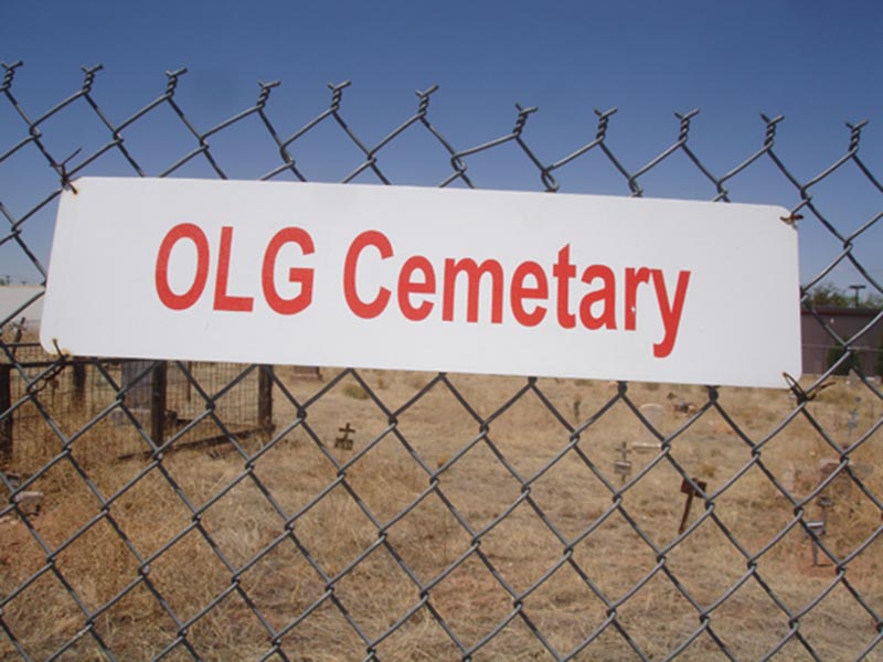
“>Pet Sematary includes “A”s, Stephen King is not to blame for the single “A” spelling variant. In fact, I’ve seen references to the word “Cemetary” predating the 1981 release of the book.

I am an occasional poster on the message system called “Reddit.” It’s funny to read online message boards where someone mistakenly misspells the word only to be chastised by other members of the forum or by spelling “bots” that make suggestions on the correct spelling…sometimes rather rudely.

Does Cemetary(sic) Spelling Matter?

Irrespective of how anyone spells the word, I never take offense at simple misspellings because I know the intended use of the word. Besides, I’ve never been a perfect speller, myself. The only time it spelling (really) matters to me is when you type in my website address. But, then, you can simply Google “The Cemetery Detective.
By following the Google links, you will be able to find the following sources:
– The Cemetery Detective Website
– My YouTube Channel with over 70 Cemetery Research videos.
– The Cemetery Detective’s Facebook Page.
– Or my Twitter Channel dealing with Cemeteries.

Do you have instances of signs with “Cemetery” written on an official sign of a cemetery? I would like to hear about them or see photos. You can contact me directly via my Contact Form.

Here are a few photos of “Cemetary” I’ve taken recently:

Sandstone Gravestones In Sewanee, Tennessee

In today’s episode of The Cemetery Detective, Keith explores the cemeteries around Sewanee, Tennessee searching for Sandstone Grave Markers.

Geology and Cemetery Research

In my mind, cemetery research and geology go hand-in-hand. Understanding geology helps me understand the types of and the uses of certain gravestone materials.

Sewanee, Tennessee lies high atop the Cumberland Plateau. The Cumberland Plateau is geologically significant. With a natural sandstone cap, sandstone is locally abundant. Because of this availability, grave monument artists have used local sandstone for generations.

Not all sandstone is the same. Area sandstone comes in several varieties. The various strata include:
Rockland Conglomerate
Vandever Formation
2 Forms of Coal
Newton Sandstone
Whitwell Shale
Richland Coal
Sewanee Sandstone

Each layer has different properties based on color and granulation. Therefore some sandstone is better suited for building material and some stone is more conducive to use in gravestones.

Liesegang Rings on Sandstone Grave Markers

An aesthetic component of many sandstone is the formation of Liesegang Rings. Monument experts simply refer to these rings as “Swirls.” Liesegang Rings are formed when and Iron-rich fluid percolates through the stone after it has hardened. The more intricate the swirl pattern the more aesthetically appealing the stone.

Limestone Gravestones

Below Sewanee’s sandstone cap lies a vast layer of limestone. Since most river water is slightly (weakly) acidic, limestone dissolves into the water. This action, over millions of years, forms caves and valleys.

Buggy Top Cave is an ideal example of a limestone cave which has been dissolved by penetrating groundwater. The limestone in the area also lends to its use as a gravestone in local cemeteries. I will be exploring more about Limestone Gravestones in the Tennessee Valley in an upcoming Cemetery Research Documentary.

Cemeteries Visited

In today’s video, I explored many cemeteries in and around Sewanee.
They include:
Martin Cemetery
Unknown Cemetery
Monteagle Cemetery
Eastern Star Cemetery
University Cemetery
O’Dear Cemetery
St. Mary’s Convent Cemetery
Wise Cemetery
Sherwood Cemetery

To understand the natural occurrence of sandstone in Sewanee, I visited: Sewanee Natural Arch
Buggy Top Trail
Buggy Top Cave

I learned a tremendous amount about sandstone from experts who patiently shared their knowledge with me.

Some of the knowledge I gleaned from experts include information on Liesegang Rings, sources of sandstone, and the physical work in forming of a gravestone.

Support my Cemetery Research

If you enjoy my cemetery research, please support my efforts:
https://www.TheCemeteryDetective.com/support

2017 Cemetery Detective Year in Review

2017 was a fantastic year full of cemetery exploration.

2017 was a fantastic year full of cemetery exploration.
Highlights include:
Completing my Submerged Cemetery Documentary
Getting featured in an Adventure Magazine for my Cemetery Research efforts
Traveling to Spain to study the cemeteries in the north of the country.

Other highlights are listed below.

Check my main page to learn about my cemetery research for 2018.


December 2017 – Cemeteries, Cameras, and Flashlights

When I was in college, I learned the art of astro-photography and darkroom film development. Being an astronomy geek, I worked at the school’s observatory helping set up the telescope and cameras. Back then, we would spend all night shooting a roll of film then spend the next morning developing the film in light-proof canisters. A lot has changed in the world of photography. Yet, the scientific principles of photography remain the same; aperture, focus (and focal length) ISO, and shutter speed is what it’s all about. Of course, the creative side is another story.

In the month of December, I’ve reawakened my love of photography. Combining photography with my love of cemeteries, I’m working to increase my understanding of creative cemetery photography. Here is a picture I took last night at Chattanooga’s Forest Hills Cemetery. Expect more photography in the coming months.

cemetery photography

In addition to cemetery photography, I’ve devoted much of my free time in December to studying cemeteries affected by flood waters both natural and man-made. Here’s an on-location photo from a cemetery I’m researching outside of a nuclear power plant. Expect a brand new Cemetery Detective mini-documentary on this subject in the very near future.

I’d like to take a moment to wish a very Merry Christmas and Happy Holidays to all my readers and fans.
Please check back often. I have a lot of cemetery adventures in store for you in 2018.

My best:

Keith


November 2017 – A Church With A Rock In It

November was such a warm and pleasant month I spent much of it in outdoor pursuits including hiking, biking, and kayaking DeSoto State Park near Mentone, Alabama.

During one of my trips there, I found Sallie Howard Chapel also known as “The Church with a Rock in It.” This chapel was built around a huge boulder jutting into the inside of the church. The boulder acts as the outside wall behind the pulpit.
It’s a fascinating church (with cemetery) and the state park is well worth a visit.


October 2017 – Magazine Articles, Newspaper Write-Ups, and Travel Abroad

October has been one of the most interesting months I’ve had in quite some time.

Points of interest during October:

– Interviewed by The Royal Gazette (Bermuda’s National Newspaper): A reporter saw my video documentary on The Cemeteries of Bermuda.
The newspaper published a newspaper article about my visits to the island.

– Researched the Cemeteries of Northern Spain: After months of planning, I toured the country by train and bus to study the old world European cemeteries of San Sebastian, Pamplona, Figueres, Girona, and Madrid. I will be posting articles in the coming days. Please check back often.

– Featured in an Adventure Magazine: Get Out Chattanooga, our regional Adventure Magazine published a featured article on my research of The Submerged Cemetery at Mullins Cove. I spent a day with a reporter. She interviewed me as we paddled 7 miles round-trip to the submerged cemetery. The article on this particular cemetery was featured in the October Issue.

the cemetery detective

the cemetery detective article

Check back soon for updates on my cemetery research trip to northern Spain.


September 2017 – A Busy September for The Cemetery Detective

Although summer is not yet over, the beginning of September has brought a respite from the heat. Warmer temperatures will, surely, return. But, for now, I’m enjoying cooler temperatures while exploring our area’s most interesting cemeteries.

At the end of August, I produced a short video dealing with my fascination of Cemetery Fences (linked below). If you enjoy my videos, please consider subscribing to my Cemetery YouTube Channel.

I have several great videos in store for you in the coming weeks including a video documentary of my upcoming Cemetery Research Trip to northern Spain. While in Spain, I will research the cemeteries of The Pyrenees, San Sebastian, and Figueres. If you live in any of those areas of Spain, please drop me a note. I always love meeting fellow cemetery enthusiasts along my journeys.

The Chain Link Fences of Rotten Bayou Cemetery
I had never been a fan of chain link fences in a cemetery….until I visited Rotten Bayou Cemetery in Diamondhead, Mississippi.


August 2017 – Cemetery Documentaries and Continued Research

Sometimes I root through my archives of cemetery pictures, video, and research documentation.  After searching through hundreds of folders, I realize I’ve published only a fraction of my archives.  This month, I’m pleased to announce the publication of two cemetery documentaries that have been on my mind all summer.

1) The Submerged Cemetery of Mullins Cove
This is one of the most fascinating cemetery stories I’ve ever researched.  This cemetery has been affected by rising waters for more than a century.  The Submerged Cemetery at Mullins Cove investigates the life histories of Henry, Zilpha, and Moses Long.  It explores the topography and geology of Mullins Cove, Tennessee.  And, it researches the reasons why this cemetery is underwater.
15 Minutes in Length and PACKED with information.


2)  The Cemeteries of St. Thomas, Tortola, Bermuda, and Newport
Earlier this year, I was incredibly fortunate to be invited to work as delivery crew on a 62′ sailboat.  We moved the sailboat from Tortola BVI to Portsmouth, RI.  On this journey, I added to my list of cemeteries I’ve already visited in these areas.  
This Cemetery Documentary chronicles my trip, the excitement of traveling on the open ocean, and the cemeteries I explored along the way.


July 2017 – Upcoming Cemetery Research

It’s been a busy summer thus far.

During June, I attended the Association For Gravestone Studies Annual Conference in Tuscaloosa, Alabama.  This was my fourth conference.  It is always an uplifting experience being around such knowledgeable and passionate cemetery enthusiasts.

At this conference, I gave a presentation on my research of The Submerged Cemetery At Mullins Cove.
I can spend hours speaking about this cemetery.  Its history is fascinating.  If your civic group would like me to give this presentation, please visit my “Public Speaking” page for scheduling information.

July is going to be busy, also.  I’m putting final touches on a new Cemetery Documentary to be released by mid-month.

Additionally, I’m preparing for a cemetery research trip to Northern Spain in the early fall.  I’ll visit the major cemeteries in San Sebastian, Girona, and Madrid.  I’m also planning on a tour of cemeteries in the eastern Pyrenees.  If you live in that area and are interested in the local cemeteries, I would love to meet you.

I’ll leave you with a couple photographs from my trip in May to the U.S. and British Virgin Islands:

cemetery_st.johns
Moravian Cemetery

tortola_cemetery
Tortola Cemetery

June 2017 – Two Cemetery Projects Underway

Check back often for updates.

1) Underwater Cemetery:

I have become fascinated with cemeteries impacted by water.
Rising waters in rivers, drought stricken lakes, and coastal areas all have affected cemeteries.
I am currently studying a cemetery in the middle of a lake.
This will be the subject of my next mini-documentary and I will also make a presentation on this cemetery during the Association for Gravestone Studies Annual Conference.


If you’re planning on attending the conference, please look me up and say “hi.” I’d love to meet you.

Flooded cemetery underwater graves.

2) Cemetery Reclamation:

I’m writing this at 11:51 PM after yet another long day in one of our local cemeteries.
With a chainsaw, lop-shears, an axe, and a strong back, I’ve taken on a project of reclaiming a long-forgotten cemetery.
When I first visited, I could not walk from one end to the other due to thickets, thorns, and brier patches. Taking care to maintain the integrity of all grave markers, I have almost completed the reclamation effort. Stay tuned to this website and my YouTube channel for a complete update.

Abandoned cemeteries.
This cemetery was completely overgrown but I’m making great progress in finding all headstones by removing the vegetation.  When finished, I plan to leave many shade trees.  However, the undergrowth will be cut away.  Tombstones will be easy to find.

Stay Tuned…


A recent mini-documentary:
The Forgotten Cemetery of Polk County Tennessee

Nestled on a forested hilltop within The Cherokee National Forest lies Rock Creek Cemetery. Even its proper name is in doubt. USGS maps, local residents, and descendants of those buried here disagree on its name. As the forest closes in on Rock Creek, this cemetery risks being lost forever.

The journey is part of the adventure and this trip was no exception. Rock Creek is surrounded by the beauty of the Ocoee river valley. This abandoned grave yard contains notable figures in Polk County’s history. In addition to the town’s founding fathers, a Revolutionary War soldier is buried here.
Join me as I search for this culturally significant cemetery.

Rock Creek Cemetery – Polk County, Tennessee


2017 Extensive Research of Cemeteries:

Big plans are underway this year. Check this website and my YouTube Channel for frequent updates.
I love feedback. So, please leave your comments and drop me notes when you see something here you like.

Cheers:

Keith

2016 Cemetery Conference – Day 4

Cemetery Time-Lapse

We have just finished a day-long tour of Cincinnati Cemeteries at the 2016 Association for Gravestone Studies.

It’s such an educational experience spending time with such knowledgeable and well educated cemetery researchers. I have lots of note and will be sharing information with you in the future.

Here’s a quick time-lapse video from one of today’s cemeteries.

Tile GPS Locator

TILE helps me keep track of my keys when I misplace them in a cemetery.

While I am adept at finding lost cemeteries, I’m not always so skilled at finding my keys in a cemetery.

On more than one occasion, I’ve left my keys behind on a gravestone before wandering off to explore other areas of the cemetery.

TILE is a handy tool that helps me keep track of my keys (and my cell phone).