McNabb Cemetery – Marion County Tennessee

A polished metal sign marks the entrance to McNabb Cemetery in Marion County, Tennessee.
Handmade. Unassuming.
Like the place it protects.

Up this gravel drive sits McNabb Cemetery. The cemetery is older than Nickajack Dam, older than the power lines streaming down the mountain’s slopes, older than the idea that this valley would ever be engineered to harness electric power for the burgeoning population of nearby Chattanooga, Tennessee.

The earliest graves date back to a time when mines operated nearby,
when families lived close to the land,
and life followed simpler rhythms.


McNabb Cemetery follows design elements of other, nearby cemeteries like the one I have explored on Aetna Mountain, known as Aetna Mountain Cemetery.

Nestled between the Tennessee River and the TVA Raccoon Mountain Pumped Storage Facility, McNabb Cemetery quietly watches two worlds pass by;
one shaped by hand tools and hard labor, the other by turbines, storage tanks, and megawatts.

Here, time moves differently.

If you never owned a calendar, you could still tell the seasons by walking these rows.
Spring brings flowers, freshly placed.
Summer brings small flags and sun-faded ribbons.
Autumn leaves collect around stones worn smooth by weather and years.
And winter brings holiday decorations and the sound of cold rain falling onto the fallen leaves.

But time doesn’t stand still and progress moves ever forward. The burgeoning population of Chattanooga is spilling over, populating the nearby mountains and altering the natural scenery.

McNabb Cemetery lies on ground surrounded by TVA property which will act as a buffer zone to protect the encroachment seen by other cemeteries in the area.

According to TVA: “The area around Raccoon Mountain is a state-designated Wildlife Observation Area. The mountaintop is home to whitetail deer, woodchucks, gray foxes and, of course, raccoons. The most compelling wildlife attraction of the area is a large wintering population of bald eagles, which can be sighted from the overlook as they hunt in the woods and waters.”

Pretty Pink Christmas Tree Grave Decoration in McNabb Cemetery

Cemeteries like this aren’t frozen in the past; they’re living records maintained not by institutions, but by families who keep showing up.

Chattanooga Memorial Park Cemetery: Red Bank/Chattanooga, Tennessee

by: Keith (The Cemetery Detective)

Introduction

Located in Red Bank, immediately adjacent to the city of Chattanooga, the Chattanooga Memorial Park Cemetery (originally known as White Oak Cemetery) sits atop rolling terrain that once served both agrarian land and Civil War strategic positioning. According to its publication, the cemetery “has been an important part of the community for more than 125 years.” Dignity Memorial+1 During my recent documentation trip I mounted a high‐resolution camera to my vehicle roof and captured a full drive‐through of the internal roadways while simultaneously logging GPS track data. This combined approach enables a temporal and geospatial documentation of the site, preserving how the landscape, stones, and pathways looked in 2025 for future researchers.


Historical Context: Community, Industry, and Landscape

In the late 19th and early 20th centuries the Red Bank and Chattanooga region grew rapidly due to railroads, wrought‐iron and steel manufacturing, coal and ore transport, and the expansion of urban Chattanooga as a regional hub. Many of the people laid to rest in this cemetery would have worked in the mills, on the railroads (including the Nashville, Chattanooga & St. Louis Railway), or in the supporting industries of the Tennessee Valley. At the same time, the location of the cemetery on higher ground above the river valley gave it both scenic appeal and symbolic permanence.

Originally designated as White Oak Cemetery, the property was described in local history thus:

“West of Hill City across Stringer’s Ridge … the Sawyer farm was acquired, and converted into a cemetery typical of those of the era.” Chattanoogan+2Dignity Memorial+2
In 1925 the name changed to Chattanooga Memorial Park after additional property was acquired. Dignity Memorial
The grounds are described as being transformed into more of a park‐like setting (particularly after landscaping efforts by long‐tenured caretakers) with features such as a duck pond and mature trees, making the site more than simply a burial ground but also a place of community memory and quiet reflection. Dignity Memorial+1


Geology, Topography and Site Layout

The topography of the cemetery reflects the region’s geological and landscape context: elevated ridges, slopes down toward the valley, and underlying limestone or sedimentary bedrock typical of east Tennessee. While specific stone‐quarry sources for monuments may vary, the choice of stone material in many of the monuments corresponds with regional availability and economic status of the families buried there.

As the site moved from farm land (the Sawyer farm and White Oak Spring area) into a landscaped burial park, the internal roadways were laid out to follow natural contours rather than rigid grids. This “park cemetery” style meant that drives are winding, uphill and downhill, allowing views over the surrounding landscape and placing monuments on terraces or gentle slopes. This design approach enhances both aesthetics and circulation.

The inclusion of the duck pond and landscaping was an early 20th‐century enhancement. The water feature further demonstrates the blending of utility and beauty: gravesites tied into a park‐like environment rather than strictly a cemetery yard. ‎Chattanoogan+1


My Temporal + Geospatial Documentation Effort

In line with the mission of The Cemetery Detective, my work at Chattanooga Memorial Park Cemetery followed a structured methodology:

  • Video Capture: Using a roof‐mounted high-resolution camera on my vehicle, I recorded a full drive‐through of all accessible internal roadways. This footage provides a continuous visual record of monuments, road surfaces, vegetation, signage, and overall condition of the cemetery at the date of recording (October 2025).
  • GPS Logging: Simultaneously I ran a dedicated GPS datalogger, logging positional data at high frequency (1-5 second interval). This produces a GPX track representing the exact route taken around the cemetery.
  • GIS Integration: After fieldwork, I imported the GPX track into QGIS (or ArcGIS) and with the future availability to overlay it with additional layers, such as:
    • Roadway polylines derived from the GPX track
    • Monument point layers (with attributes: material type, erection date, condition, inscriptions)
    • Special feature layers (duck pond, elevated ridges, park landscaping zones)
    • Temporal metadata linking frames of the video (via start time) to GPS coordinates.
      This allows for queries like “show all granite monuments erected before 1950,” or “highlight sections of the cemetery where road surface appears recently repaved or vegetation encroaching.”
  • Shareability & Future Use: By making these layers (GPX track, CSV/GeoPackage of monuments, and the video) available for download and archival, future preservationists, genealogists, and local historians can reference exactly how the cemetery looked in 2025, even as time (and weather, vegetation, development) inevitably changes the site.

Preserving Memory, Managing Change

Cemeteries like Chattanooga Memorial Park serve dual roles: resting places for individuals and collective memory landscapes for the community. The Red Bank/Chattanooga region continues to evolve with residential growth, infrastructure changes, and shifting maintenance regimes all affecting the condition and appearance of the cemetery. By providing a base-year documentation (2025) that is both visual and spatially precise, we create a benchmark against which future change can be measured.

For example: if in five years a major tree falls and damages monuments in a section; or if resurfacing alters the alignment of a road; or a cluster of older marble headstones begin to tilt, having a linked video + GPS + GIS dataset allows one to show exactly where and when change occurred.


Conclusion

My work at Chattanooga Memorial Park Cemetery in Red Bank/Chattanooga, Tennessee, is grounded in the belief that historic cemeteries merit the same precision of documentation as any heritage site. Through mounted video, synchronized GPS logging, and GIS layering, I am capturing a snapshot of this landscape as it stands in 2025. By doing so, we are able to honor not only the individuals interred here but the communities, industrial heritage, and topographic character that shaped the burial ground. Through these efforts conducted by myself and other cemetery enthusiasts, we equip future generations with a tool to monitor, research, and preserve this important piece of Chattanooga’s past.

Documenting Forest Hills Cemetery (Chattanooga, TN)

By The Cemetery Detective — Forest Hills Cemetery, St. Elmo / Lookout Mountain foothills (2025 visit)

Forest Hills Cemetery is one of Chattanooga’s oldest and most historically layered burial grounds. Forest Hills was established in 1880, sitting at the foot of Lookout Mountain, and serving generations of local families, veterans (including Civil War interments), and the city’s industrial communities. The cemetery is large (roughly 100 acres with tens of thousands of recorded burials), contains distinctive historic monuments (including a prominent Confederate memorial), and has a documented map maintained by the Forest Hills Cemetery Association. All of these are reasons why a careful, repeatable program of temporal and geospatial documentation is valuable.

Below I describe the independent work I performed at Forest Hills, the same two-part approach I use at other sites: (A) temporal documentation (video with meta timestamps) and (B) spatial precision (GPS tracklog). Then I expand on how I prescribe to use GIS to build layers that make the cemetery data queryable, searchable, and useful for specialized research (for example: mapping all marble stones, all granite monuments, and locating zinc markers).


Why Forest Hills Benefits from this Approach

Forest Hills is a historic community cemetery serving people tied to Chattanooga’s growth. Miners, railroad and ironworkers, Reconstruction-era families, fraternal organizations, and local civic leaders have all been served by Forest Hills Cemetery. Its location near Lookout Mountain and the St. Elmo neighborhood gives it both scenic and historical significance. The scale of the site and the importance of certain monuments mean that a year-by-year visual record plus geospatial layers give historians, genealogists, and municipal stewards a repeatable way to answer questions like: where are all of the Civil War veteran graves, which areas show accelerated stone weathering, or which lots contain zinc markers that are prone to a distinct corrosion pattern.


Temporal Documentation: video drive-throughs and targeted still photography

My video drive-through captures the roads and lanes as a continuous, date-stamped visual record. For Forest Hills I did:

  • A slow drive covering primary loops and secondary lanes, filmed at 1080p+ with steady mounting and embedded time-calls at the start and end of each pass.
  • Walk-and-shoot segments for notable monuments: the Confederate monument, large marble angels and sculpted figures, mausolea, and any zinc (white-metal) markers I could find. Photographs of inscriptions were captured at high resolution for later transcription. (Zinc markers stand out visually and require different conservation attention than granite or marble.)

Why video + close photos? Video records context of tree cover, sightlines, road surfaces, decorations, and temporary items while still photos capture legible inscriptions and fine detail for transcription and material identification.


Spatial documentation: GPS logging and GIS-ready GPX files

Simultaneously with the video I logged the drive routes using a high-accuracy GPS datalogger (1–5 second sampling). I export GPX tracks and bring them into GIS software (QGIS/ArcGIS). These GPX polylines form the skeleton I use to anchor video timestamps to exact map locations. These datapoints enable a researcher to jump from a map coordinate to the corresponding moment in the video.

I also collect single-point GPS fixes for specific features (e.g., unusual monuments, zinc markers, mausolea, cemetery sign). Each point is given a unique ID and linked to high-resolution photos and a short descriptive note (material, inscription legibility, condition).

Forest Hills maintains an official map and burial records which I use as a reference layer when positioning my features within the cemetery’s section/lot grid.


Building GIS Layers: a reproducible, queryable data model

The value of GIS is not just a pretty map. GIS’ beauty comes from its ability to store attributes and filter/query them. Cemeteries like Forest Hills, benefit from maintaining core layers:

  1. Base layers
    • High-resolution orthophoto (if available), or current aerial basemap.
    • Cemetery property boundary and scanned official map (georeferenced PDF).
  2. Road & Pathway polylines
    • Created from GPX tracks; each polyline has attributes: road_name, drive_direction, record_date, video_file, video_start_time, video_end_time.
  3. Plot/Section grid (vector polygons)
    • Digitized from the cemetery’s official map and/or from on-the-ground GPS corner points. Attributes: section, lot, availability, notes.
  4. Monument points (the key research layer)
    • One point per monument/marker with attributes such as:
      • feature_ID (unique)name_on_marker (if legible)primary_material (marble, granite, limestone, zinc, bronze, concrete, etc.)secondary_material (base/ornament)marker_type (upright, flat, ledger, obelisk, mausoleum, zinc_tablet)date_erected (if inscribed)inscription_text (full or partial transcription)condition_score (numeric or categorical — e.g., 1–5)photo_refs (filenames, with timestamp)GPS_accuracy and recorded_by metadata
    This layer is what lets us answer queries like “show me all marble markers,” or “select all zinc markers installed before 1910.” Mapping material is essential to studies in cemetery geology and conservation because materials weather differently and tell us about sourcing and local trade patterns. (In Forest Hills marble appears commonly on older monuments; zinc monuments are less common but highly distinctive.)
  5. Zinc markers — an explicit sub-layer
    • I often create a zinc feature class (or a boolean field is_zinc) because zinc monuments (a.k.a. “white bronze”) were popular 1870–1920 and have specific conservation and provenance stories. Zinc’s patina and brittle mounting methods make them a separate conservation case. Treating them as a distinct layer makes preservation tracking straightforward. (Readers of Forest Hills note a singular or small number of zinc markers among the granite and marble landscape.)
  6. Vegetation & tree canopy
    • Large trees can obscure inscriptions, damage stones through root action, or alter microclimates that accelerate biological growth on stone. I map specimen trees and canopy cover where relevant to monument condition assessments.
  7. Historic overlays
    • Georeferenced historical maps, insurance plat maps, city directories, and old aerials. These let one detect reinterments, landscape changes, or realignments. Forest Hills’s long history and the movement of some graves across the city is why historical overlays are useful.

Example GIS queries and analyses you can do once layers exist

  • “Select all monuments where primary_material = 'marble' and date_erected < 1920” — to study Victorian marble weathering patterns.
  • “Map all is_zinc = TRUE points and buffer 1 meter to assess mounting/settlement issues.”
  • “Join the monument layer to burial registry tables by name_on_marker and burial_date to create a searchable, name-indexed map.”
  • “Temporal change detection: overlay photos from 2015, 2020, 2025 to automatically flag monuments with new tilt/fallen status.”
  • “Slope/DEM analysis: identify plot areas with slope > X degrees where erosion or soil movement threatens stones.”

Practical GIS tips & file management

  • Coordinate Reference System (CRS): capture GPS in WGS84 (EPSG:4326), but store and perform local spatial analysis in an appropriate projected CRS for Tennessee (e.g., NAD83 / Tennessee State Plane or UTM zone that minimizes distortion) when you need accurate area/length measurements.
  • Attribute templates: use consistent field names (snake_case or camelCase) and controlled vocabularies (e.g., a fixed list of materials) to keep queries reliable.
  • Photo & video linking: store media files with filename conventions that match feature_ID or include timestamps; keep a CSV or GeoPackage attribute that lists the media filenames so a map click can open the photo or jump to the time in the drive-through video.
  • Backups: keep raw video and original GPX tracks (uncompressed where possible) and create web-friendly derivatives (MP4, simplified GeoJSON/GPX) for publication.
  • Public export: consider publishing a sequence of KMZ/GeoJSON files and a CSV index for other researchers along with the site’s permission.

Forest Hills Cemetery: communities and industrial past visible in stone

Walking Forest Hills, you’ll see the social layering in funerary art:

  • Veterans’ memorials: there are many veteran markers.
  • Industrial families & fraternal stones: the rise of Chattanooga’s manufacturing and rail era is reflected in obelisks, ledger-style stones for prominent families, and many fraternal emblems (Masonic, Woodmen of the World). The materials chosen, often marble for 19th-century Victorian markers and granite later, echo the economics of the era and local stone/transport availability.
  • Ethnic and community histories: Forest Hills contains burials from across Chattanooga’s social history, including Reconstruction-era African American sections that document once-segregated burial practices. Such patterns should be recorded sensitively and with reference to local office records.

Mapping these social layers by veteran status, fraternal membership, material type, and erecting date lets researchers visualize how the community’s funerary landscape reflects Chattanooga’s industrial and social history.


Why publish this work on TheCemeteryDetective.com?

A well-organized public archive (video + map + downloadable GPX/GeoJSON + searchable CSV of monuments) does three things:

  1. Preserves a temporal snapshot (how Forest Hills looked in 2025).
  2. Provides spatially precise references for genealogists and conservators.
  3. Enables research queries (e.g., find all zinc markers, list all marble markers erected before 1900, or show areas where canopy cover may be harming stones).

Forest Hills Cemetery, given its founding date, scale, and visible memorial types, is particularly well-suited to this kind of combined preservation work.

Demonstrating what is Possible

A full-scale Temporal and Geospatial Documentation project requires a significant commitment of resources and coordination from cemetery management. My visit to Forest Hills Cemetery in Chattanooga represents a focused effort to demonstrate what is possible when technology and historical preservation meet. During my time in Forest Hills, I recorded a complete visual record using a roof-mounted GoPro camera while simultaneously capturing temporal and geospatial data via GPS. Together, these data form a lasting digital archive. It is a snapshot (video) of the cemetery’s layout, demography, and pathways as they exist today. In the years to come, as landscapes evolve and headstones weather, this record will stand as a vital reference point for researchers, genealogists, and future caretakers dedicated to preserving the memory and material heritage within Forest Hills Cemetery.

References:
Find A GraveForest Hills Cemetery in Chattanooga, TennesseeLocated in St. Elmo at the foot of Lookout Mountain, Forest Hills Cemetery was established in 1880 by a group led by Colonel Abraham Malone Johnson.

taphotourist.comForest Hills Cemetery by The TaphotouristForest Hill’s historical graves boast scores of Civil War veterans, industrialists, Reconstruction Era African Americans (when graves were still segregated – a …

thecemeterytraveler.blogspot.comChattanooga and Forest Hills CemeteryJul 17, 2015 — There was the singular large zinc monument among the granite and marble. There were twin, life-sized marble angels flanking a giant column.

foresthillscemetery.netScanned Document – Forest Hills CemeteryMAP OF. FOREST HILLS CEMETERY. PROPERTY OF. FOREST HILLS CEMETERY ASSOCIATION. CHATTANOOGA TENNESSEE … www.foresthillscemetery.net.

foresthillscemetery.netForest Hills Cemetery – ChattanoogaLocated in St. Elmo at the foot of Lookout Mountain, Forest Hills Cemetery was established in 1880 by a group led by Colonel Abraham Malone Johnson. Forest …

adventuresincemeteryhopping.comTaking a Spring Stroll in Chattanooga’s Forest Hills …Jun 7, 2019 — Rare White Bronze Marker. The last marker I wanted to talk about is this white bronze (zinc) one, a rarity in a Southern cemetery. Finding …

adventuresincemeteryhopping.comJune | 2019 | Adventures in Cemetery …Jun 14, 2019 — It’s called Guess Who’s in the Mausoleum. While doing research on Forest Hills Cemetery’s mausoleums, I found myself eye-deep in this game.

thecemeterydetective.comForest Hills Cemetery – Chattanooga, TennesseeApr 2, 2014 — Monument at Forest Hills Cemetery – Chattanooga, Tennessee Forest Hills Monument … – A Zinc Grave Marker! Florence City Cemetery – YOU WON’T RUN …

thecemeterydetective.comCemetery Discoveries – Page 8 of 11Nestled within the Lookout Mountain foothills, Forest Hills Cemetery is easily one of the most interesting cemeteries in Chattanooga, Tennessee. Whenever I am …

tngenweb.orgForest Hills CemeteryForest Hills Cemetery was founded in 1880 and is in use to the present day. It covers approximately 100 acres. It has over 43,000 recorded burials with space …

tngenweb.orgForest Hills Cemetery, Hamilton Co. TNMar 1, 2008 — Longitude, -85.323013. Elevation, 715. USGS map, Chattanooga. Location, 4016 Tennessee Ave., Chattanooga. Recorder. Access. Upkeep. Size. Survey …

tngenweb.orgForest Hills CemeteryMar 25, 2006 — Forest Hills Cemetery is three miles south of Chattanooga at the foot of Lookout Mountain. It was incorporated in 1885 by the late Col. AM Johnson.

mapquest.comForest Hills Cemetery, 4016 Tennessee Ave, Chattanooga …Get more information for Forest Hills Cemetery in Chattanooga, TN. See reviews, map, get the address, and find directions.

findagrave.comForest Hills Cemetery (Chattanooga, TN)Forest Hills Cemetery. Chattanooga, Hamilton County, Tennessee, USA. Plot info: Section P, Lot 175. Lena Laurens Ferguson Freeman Flowers have been left.

waze.comDriving directions to Forest Hills Cemetery, 4016 …4016 Tennessee Ave, Chattanooga, Tennessee, United States. Open in Waze. (423) 821-4161 · foresthillscemetery.net. Closed now. Sunday08:00 – 18:00.

causeiq.comForest Hills Cemetery Association | Chattanooga, TNAddress: 4016 Tennessee Ave: Chattanooga, TN 37409 ; Metro area: Chattanooga, TN-GA ; County: Hamilton County, TN ; Website URL: foresthillscemetery.net/ ; Phone: ( …

tripadvisor.comForest Hills Cemetery, ChattanoogaForest Hills Cemetery is a very large cemetery located near the bottom of Lookout Mountain in the St. Elmo neighborhood district.

wikitree.comCategory: Forest Hills Cemetery, Chattanooga, TennesseeJan 1, 2023 — Name: Forest Hills Cemetery. Location: Category: Chattanooga, Tennessee. Address: 4016 Tennessee Avenue, Chattanooga, Tennessee, 37409.

Documenting Ishpeming Cemetery: why a drive through and GPX tracks matter

By The Cemetery Detective — Ishpeming, Michigan (2025 visit)

Ishpeming Cemetery sits on a gentle hill above Deer Lake Avenue in Ishpeming, Michigan. It’s a municipal cemetery with an extensive set of burial records, a mapped layout, and a long local history. This history includes the relocation of older graves from an earlier town burying ground in the late 1800s. Because of that layering of sites, re-interments, and shifting pathways, a good modern documentation record is especially valuable for historians, genealogists, and municipal preservation efforts. ishpemingcity.org+2ishpemingcity.org+2

Cemetery Documentation

During my recent trip I recorded a full “drive-through” video of the roadway network inside Ishpeming Cemetery. A video drive-through captures a continuous, human-scale view of every gravestone, fence, tree, sign, and pathway as they appear from the roads at the moment of recording. That single camera run becomes a fixed timestamp. Future researchers can see what a particular plot, marker, or avenue looked like in 2025.

Why that matters for Ishpeming in particular

  • The City of Ishpeming maintains burial records going back to the 1890s and publishes maps and a cemetery ordinance. But maps and lists don’t fully convey what a space feels like or how vegetation, monuments, and road surfaces appear at a moment in time. The city’s cemetery office is a great place to start if you need interment records or plot layout. ishpemingcity.org+1
  • Ishpeming’s earlier burying ground (near North, Pine and Maple Streets) was cleared and many remains were moved to the present site on Deer Lake Avenue between 1905 and 1911; that history makes a living photographic/film record valuable for tracing which markers and landscape features are original and which reflect later re-interment or landscaping. miningjournal.net

Video + GPS: a two-part preservation approach
Video alone is excellent for visual context, but it lacks precise spatial coordinates. That’s where GPS comes in. During my drive-through I also logged the roadway with a datalogger and exported the resulting GPX file into GIS software. Combining the two gives us:

  1. Temporal evidence (video): what each marker and roadway looked like in 2025 To the best of the video’s ability, wear, inscriptions, vegetation, signage, and temporary features (flags, decorations, construction cones) are recorded.
  2. Spatial precision (GPX → GIS): meter-level accurate polylines for the cemetery roads so the video frames can be tied to exact map locations, enabling future researchers to jump to locations in both the map and the video. (Ishpeming Cemetery’s coordinates place it in Marquette County; the site is documented in public place name databases.) TopoQuest+1

Processing Cemetery Data

How I process and store the data (practical steps you can reuse)

  • Video capture: steady dash or handheld camera, 1080p or higher, set to record continuously during the roadway pass. Note start/stop times precisely and say the start time out loud into the camera that audio timestamp helps later synchronization.
  • GPS log: run a dedicated datalogger or a smartphone app that records GPX tracks sampling at 1–5 second intervals. A dedicated external GPS (with WAAS/EGNOS enabled) will gives better positional accuracy than my phone.
  • File naming & metadata: name files with cemetery name, date (YYYYMMDD), device ID, and direction (e.g., IshpemingCemetery_20250512_dash_roadA_EW.mp4 and IshpemingCemetery_20250512_dash_roadA.gpx). In the video’s metadata or a separate text file, note weather, vehicle speed, and any interruptions.
  • GIS import: import the GPX into QGIS or ArcGIS as a track and convert those tracks to polylines representing each roadway. Use the cemetery’s official map (the City of Ishpeming publishes one) to reference section names/plot grids.
  • Syncing video to map: either slice the video into short clips tied to road segments and reference them in attribute tables, or keep one continuous video and store timestamps for notable markers. For an indexed archive, create a spreadsheet (or a GeoPackage attribute table) with columns: file, start_time, end_time, GPX_segment_ID, feature_notes, photo_refs.
  • Backups & formats: keep originals in uncompressed or high-quality formats and create web-friendly MP4s for publishing. Store everything in at least two locations (local SSD + cloud vault).

Future Use of Cemetery Documentation

Examples of research uses

  • Genealogists tracing families recorded in the city’s burial index can match names to visible monuments in the 2025 video and confirm inscriptions and monument types. Ishpeming has thousands of memorial records online (for example, Find A Grave lists many memorials for this cemetery), making a combined visual + spatial archive extremely useful. Find a Grave+1
  • Preservationists can compare year-to-year videos to detect new damage (fallen markers, vandalism), landscape changes, or road realignment.
  • Municipal staff and historians can reference the footage during repair or relocation work (remember the major reinterments from the early 1900s — misplaced or missing Potter’s Field graves were historically an issue). miningjournal.net

A few “Cemetery Detective Quick Tips” when filming in cemeteries

  • Be respectful: follow posted rules (Ishpeming Cemetery posts hours and site rules).
  • Slow and steady wins: drive slowly and keep motion smooth so to reduce blurriness of headstone images.
  • Capture the sign(s): a clear shot of the cemetery sign and any dated plaques helps future viewers instantly confirm place and policy context. (Ishpeming’s entrance signage is distinctive and useful for this.)

Where to get official records for Ishpeming Cemetery
If you want burial records, maps, or to ask about historic reinterments, contact the Ishpeming Cemetery/DPW office. The city publishes burial records and a cemetery map online and provides contact details for records requests. That’s also the proper channel for asking about permissions if you plan to do comprehensive documentation. ishpemingcity.org+1

Why I publish these archives on TheCemeteryDetective.com
Cemeteries are living history: monuments, plantings, and even road alignments change. A public, well-indexed archive (video + GPX + metadata + city record references) preserves how a place looked and functioned in a year. These act as snapshots that future researchers, family members, and municipal stewards will thank us for. For Ishpeming, with its deep mining-era roots and reinterment history, these snapshots help link names on paper to stones in the ground and to the landscape in between. miningjournal.net+1

References:

billiongraves.comOlga Olgren – BillionGraves GPS HeadstonesAccess burial information, GPS coordinates, and family connections. Gravestone commemorating Olga Olgren

facebook.comIshpeming MI – Cemetery (Dates later than 1900 blacked …Jun 5, 2025 — The first recorded burial at the Catholic Cemetery in Ishpeming was on May 3, 1871, being that of Martin Wall. The last burial was of Joseph …

facebook.comIshpeming Area Historical Society & MuseumPlease mark your calendar with the dates for the 2026 Ishpeming Cemetery Tour which will lift up the memory of the miners who were killed in the Barnes-Hecker …

facebook.comTiny cemetery near Montague, Michigan with famous graveNear the town of Montague, Michigan you will find this tiny cemetery. There is 17 graves listed and one who is kind of famous.

facebook.comThe Ishpeming cemetery is open to Residents and nonThe Ishpeming cemetery is open to Residents and non-residents alike. Burial plots can be purchased now with group discounts available.

mapquest.comIshpeming Cemetery, Deer Lake Rd …Get more information for Ishpeming Cemetery in Ishpeming, MI. See reviews, map, get the address, and find directions.

uppermichiganssource.comWorld War I remembered at Ishpeming CemeteryJul 9, 2017 — History enthusiasts had a chance to learn more about World War 1 Sunday afternoon at the Ishpeming Cemetery.

ishpemingcity.orgCemetery MapIshpeming Cemetery Map. Phone: (906)485-1091 • Fax: (906)485-6246 • City Hall: 100 E. Division Street, Ishpeming, MI 49849

findagrave.comIshpeming CemeteryAndrew Anderson Flowers have been left. Memorial ID. 28 Dec 1885 – 15 Mar 1933. Andrew Anderson was born June 4,1886 in Ishpeming…

findagrave.comCemeteries in Ishpeming, Michigan3 cemeteries in Ishpeming, Michigan. Barnes -Hecker Mine Memorial · Ishpeming Cemetery … cemeteries found in Ishpeming, Michigan will be saved to your photo …

findagrave.comBarnes -Hecker Mine Memorial in Ishpeming, MichiganJan 14, 2018 — 1137-2939 County Road Cl Ishpeming, Michigan 49849 United States Coordinates: 46.50309, -87.77913 Members have Contributed About these numbers

ishpeminghistory.orgIshpeming Timeline1967 – Cliffs Shaft Mine ceased operation. 1970 – The population of Ishpeming was 8,245 1973 – Cliffs Shaft Mine was designated a state of Michigan historic …

coordinatesfinder.comGPS coordinates for Ishpeming MichiganGPS coordinates for Ishpeming Michigan · Latitude: 46.4885469. Longitude: -87.6676358 · More coordinates for Ishpeming Michigan · Extra information about Ishpeming …

coordinatesfinder.comGPS coordinates for ISHPEMING, MIGPS coordinates for ISHPEMING, MI · Latitude: 46.488547. Longitude: -87.667636 · More coordinates for ISHPEMING, MI · Extra information about ISHPEMING, MI.

michigangravestones.orgIshpeming Cemetery – Marquette County, MichiganBurials in Ishpeming Cemetery, Marquette County, Michigan. Find genealogy and surname records in Marquette County, Michigan.

bjorkandzhulkie.comObituary | Anthony Donato Gagliardi of Ishpeming, MichiganMar 29, 2018 — A private family burial will take place at the Ishpeming Cemetery following the funeral luncheon. The family requests, due to allergies …

youtube.comIshpeming Area Historical Society Cemetery Tour Returns For …ISHPEMING, Mich – A local cemetery tour is returning this August. The Ishpeming Area Historical Society Cemetery Tour will take place every …

expertgps.comMap and Download 3398 Cemeteries in Michigan to your …Map and Download GPS Waypoints for 3398 Cemeteries in Michigan. Click here … Ishpeming Cemetery; Additional Cemeteries in Nearby Towns: Negaunee, Ely …

waltersfamilytree.netIshpeming Cemetery, Ishpeming, Marquette, Michigan, USAIshpeming Cemetery, Ishpeming, Marquette, Michigan, USA: Walters Family Tree. … Cemetery Records · Census Records · Church Photos · City Directories · Civil War …

genealogybuff.comMarquette County, Michigan Obituary Collection – 45Jun 16, 2011 — Burial will be in the Skandia Lutheran Cemetery, with Russell Westman, Dan Johnson, Brian Weatherdon, David Lehtinen, Mark Anderson and Al …

billiongraves.comIshpeming CemeteryLoading Cemetery…

Crisis in the Early Days of Greenwood Cemetery – Petoskey, Michigan

00:00 Introduction to Greenwood Cemetery
00:30 Introduction to Petoskey, Michigan
01:00 Mission Statement
01:30 Birth of Petoskey, Michigan
01:45 Size and Scope of Greenwood Cemetery
05:00 History of Petoskey, Michigan
06:00 The Need for a City Cemetery in Petoskey
08:00 Pandemic and World War I
14:00 Community Identity through its Cemetery

This video provides an overview of both the Greenwood Cemetery in Petoskey, Michigan, and the early history of Petoskey City itself.

The documents related to Greenwood Cemetery, a perpetual care municipal cemetery, detail its history, arboretum status, staff, and essential information like burial options and contact details, while the visitor guide outlines rules for guests concerning hours, respecting the peace, and pet guidelines.

Separately, an article from 1921 recounts the founding and growth of Petoskey beginning in 1873, focusing on its initial development around the railroad, including the first structures, settlers, and the influence of the local Ottawa tribe.

Collectively, this video looks at both a significant contemporary landmark and the historical origins of the surrounding area.

References:
https://www.TheCemeteryDetective
https://www.gwood.us/
https://www.gwood.us/visitor-guide
https://gwoodazure.blob.core.windows…. https://gwoodazure.blob.core.windows….

A Modern Walk Among the Tombs in the Spirit of Muir at Bonaventure Cemetery

By Keith Harper – The Cemetery Detective

After weeks of slow travel through the Southern lowlands, I arrived at Bonaventure Cemetery by way of the old river road, winding along the fringes of Savannah, Georgia. 

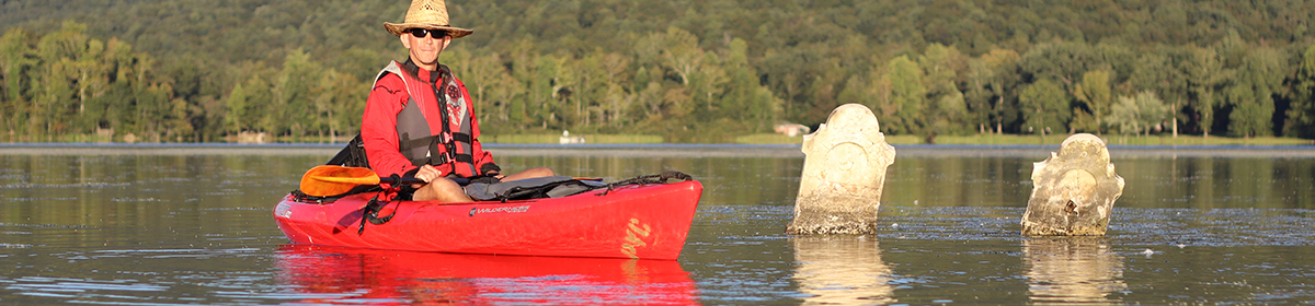
My car, a modified 2015 Honda Accord that I have come to call the Hondaminium, carried all my necessary provisions: sleeping platform, boots, books, kayak strapped on top, a notebook of my geological field drawings, and a laptop computer filled with video and photos and GIS Maps from my prior cemeteries. It is a humble vessel, but it has taken me across this continent and into the quiet corners where stone and memory meet.

In no way would I ever compare my wanderings to those of John Muir, but in some ways, he inspires the paths I take. John Muir was a great naturalist and founder of the Sierra Club. He was not just a mountaineer of the western ranges but a wandering philosopher of the American landscape. In 1867, after a factory accident left him temporarily blind, he set off on foot from Indiana to the Gulf of Mexico, seeking healing in the wild. With a handmade plant press and a tattered copy of Paradise Lost, he walked over 1,000 miles alone, penniless, often sleeping beneath trees or in abandoned cabins. His journal from that journey, later published as A Thousand-Mile Walk to the Gulf, is a blend of scientific observation, spiritual reflection, and poetic wonder. One chapter, “Camping Among the Tombs,” describes six nights he spent in Bonaventure Cemetery, then a largely forgotten tract of live oaks and old gravestones on the edge of Savannah. Far from finding it morbid or melancholy, Muir saw in Bonaventure a sublime harmony between life and death, nature and memory. It is this chapter, and that sense of reverent curiosity, that I carried with me on my own visit.

I arrived at Bonaventure Cemetery on a warm, still morning. The air tasted faintly of salt and pine. Great arms of live oak stretched over the road, their limbs clothed in Spanish moss and resurrection ferns. I passed ragged fields, broken fences, and a series of stilt-legged cottages near the water. Just beyond, the forest seemed to open, and I knew I had arrived.

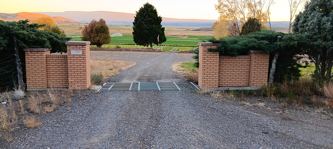
The gates of Bonaventure stood solemn yet inviting. I parked beneath a canopy of green and began my walk.

The ground was soft and littered with pine needles and camellia petals. Oaks, magnolias, and palmettos formed groves around the family plots, their trunks straight and noble as stone columns. Muir once wrote, “One can hardly think of another place where the natural and the supernatural seem so lovingly entwined.” I found it to be just so. Nature was not in conflict with the dead here; it walked hand in hand with them.

I wandered slowly, as I always do in these places, letting my attention fall equally on the botanical and the sepulchral. My interest in graveyards is not born of morbidity, but of inquiry. I am a student of geology by inclination, and of cemeteries by profession. I believe every gravestone tells a dual story; one of the person it memorializes, and another of the earth it was carved from.

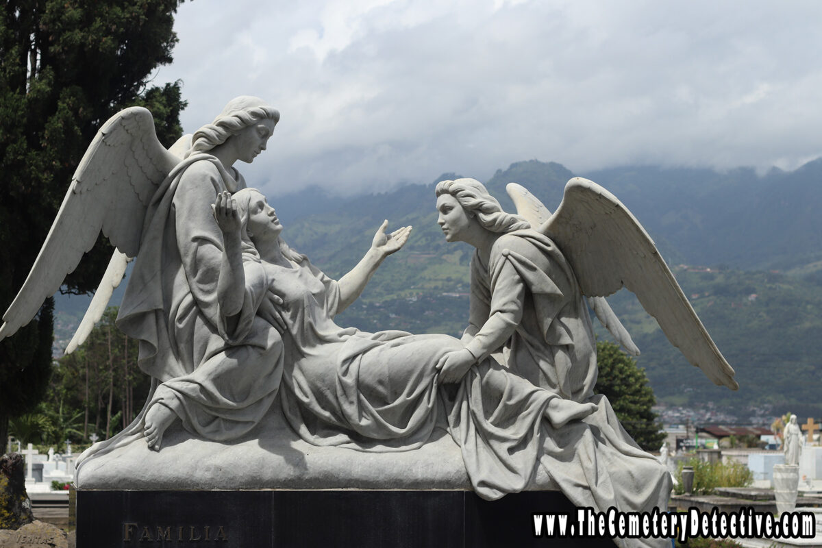
Many of the oldest monuments in Bonaventure are made of marble, that metamorphic product of pressure and time, beloved by sculptors for its softness and by mourners for its elegance. But marble is a delicate stone in humid air. Acid rain and salt drift from the river cause it to sugar breaking it down into powdery grains that slough away with the years. As I examined a white marble headstone adorned with an angel now almost faceless, I saw the inscription was worn smooth. Only the outline of the angel’s wing remained to hint at the stonecutter’s intent. A slow and silent erosion, like memory fading.

Farther along I found granite markers, darker and more stoic. Their inscriptions were sharp still with biotite and quartz reflecting the midmorning light. Granite does not sugar, though it may crack. It is igneous, born of ancient heat and cooling deep within the crust. These stones, quarried in Georgia or Vermont or sometimes as far away as India, will likely outlast the names they carry.

Each monument I came upon presented a different combination of material and meaning. A column broken midway to symbolize a life cut short. A weeping willow carved in relief upon slate. A clasped hand, the fingers gently parting. These symbols are not idle ornaments, they are languages I strive to interpret, which still speak for those long gone.

Bonaventure is not a place of fear. It is a place of stillness and story. As Muir observed in his own visit here over 150 years ago, “the few graves are low and in no way interrupt the general flow of the forest floor.” Life persists. Resurrection ferns curl and unfurl on tree limbs. Mockingbirds call from the thickets. The dead rest not beneath but within the rhythm of the landscape.

At one quiet bend in the path, I stopped and stood for a long time, staring into a dense pocket of shrubbery beyond a weathered family plot. The sun filtered in through the moss, and for a moment, the cemetery fell utterly silent. I imagined Muir here, weary from the road, swatting at mosquitoes, settling down amid the roots and stones. He wrote that he chose Bonaventure as a place to sleep because it was safer than the surrounding wilderness, yet awoke to find his head resting on a freshly dug grave. The image clung to me. As I stood among the brush, I could almost see him lying there, curled among the palmettos, journal clutched to his chest.

Later that afternoon, I unstrapped my kayak from the roof of the Hondaminium and carried it down to the nearby water’s edge. I paddled through narrow inlets where cypress knees broke the water’s surface and egrets stalked the reeds. The Wilmington River, wide and flat, moved lazily past the cemetery’s bluff. I drifted beneath the very trees I had stood among that morning, their roots braced in mud, their limbs catching wind and whisper.

It felt right to trace the edge of the graveyard by water. Water, like time, wears down even the hardest stone. And like grief, it cannot be held still.

That night, I returned to my car. I prepared a modest supper from my cooler and reclined the seat to re-read John Muir’s chapter by headlamp. I thought of Muir sleeping among the tombs, wrapped in the scent of earth and fallen leaves. I could not bring myself to unroll my bedroll within the cemetery gates because the times and laws are different now, but I car-camped nearby, safe in my Hondaminium tucked beneath an oak on a tree-lined street. As I unfolded my mattress on my sleeping platform with my head resting cozily on a soft, cool pillow, I thought about Muir resting his head on a freshly dug grave, and in spirit I shared the same peace as John did.

Bonaventure had given me what it had given Muir: a quiet place to study, to wonder, and to reconnect with the simple fact that we, too, will return to the elements from which we came. Stone, soil, water, breath.

In the morning, I walked once more beneath the arching oaks, their limbs still heavy with moss and memory. I took no souvenirs, only notes and a few final photographs, though none could capture what lingered in the air. My footprints, soft upon the pine needles, were soon erased by the breeze. The cemetery remained as I had found it: solemn, sun-dappled, and quietly alive. As I turned back toward the road, I thought of Muir rising from his earthen bed, brushing off the dew, and continuing his thousand-mile walk. I had come by car, not by foot, and stayed just a short while, yet I, too, left changed. In Bonaventure, among the tombs and trees, we had both found something enduring; not death, but the echo of life, layered in stone and soil, whispering still.

Mapping History: Uncovering Utah’s Cemeteries Through Data

Accessibility Study of Cemeteries within 5 miles of exit ramps on Utah's major roadways.

As “The Cemetery Detective,” I spend a lot of time searching for stories etched in stone and buried in the past. But this time, my investigation took a different turn: instead of walking through rows of gravestones, I found myself walking through rows of data. The result? A map that not only pinpoints cemeteries across Utah but also illustrates their proximity to major roadways and helps us understand their distribution by county.

This project started with a simple question: how many cemeteries in Utah are located within one mile of a major road? The answer wasn’t buried in an archive or scratched on an old headstone—it was buried in datasets. Using GIS (Geographic Information Systems) tools, I combined county boundary data, road network data, and cemetery locations, working through layers of information to reveal a visual story.

The result? A map that highlights cemeteries within easy reach of highways and ramps. It’s not just a neat visualization—it’s a functional tool for historians, genealogists, and travelers. Whether you’re researching family history or planning a weekend road trip to explore Utah’s history, this map helps you see how accessible these burial grounds are. It also provides insight into population density, historical settlement patterns, and even how topography has influenced where people chose to bury their loved ones.

But what excites me most about this project isn’t just the map—it’s the process and the possibilities it reveals for the future.

What’s Next?

This map is just the beginning. It’s an example of how we can take raw data, massage it into a usable form, and use it to ask meaningful questions. In the future, I plan to dive even deeper into the stories behind the cemeteries.

Here are a few upcoming projects I’m excited about:

  1. Mapping Cemetery Longevity: How old are Utah’s cemeteries, and how does their age correspond to historical migration trends? By layering this data with other historical maps, I hope to identify the rise and fall of communities across the state.
  2. Gravestone Materials and Patterns: Can we map out the use of materials like marble, granite, or sandstone by region or time period? This might reveal the economic or cultural influences of those who lived (and died) here.
  3. The Impact of Accessibility: How does proximity to major roads affect the preservation of cemeteries? Are easily accessible burial grounds better maintained than remote ones?

This is where GIS and cemetery research become truly exciting: they don’t just answer questions—they spark new ones.

Why Does This Matter?

Cemeteries are more than places of rest—they’re repositories of culture, history, and memory. Mapping them isn’t just about finding their locations; it’s about preserving their significance. By connecting geography, history, and technology, I hope to create tools that help others explore the past while inspiring more appreciation for these sacred spaces.

Whether you’re a researcher, an explorer, or just someone curious about the hidden stories in your hometown, there’s so much we can learn by uncovering what’s beneath the surface—both literally and figuratively.

For now, I’ll keep digging—both into data and into history. Who knows what stories the next map might reveal? Stay tuned for more adventures from “The Cemetery Detective.”

Cementerio General in San José, Costa Rica: A Journey through History, Art, and Culture

On my recent journey to Costa Rica, I was privileged to explore Cementerio General. Cementerio General is a renowned cemetery in San José with over a century of history, architectural beauty, and cultural significance.

Known as the “City of the Dead,” Cementerio General offers visitors an insightful glimpse into Costa Rican society. The artistic expressions of its people and the profound stories of individuals who shaped the nation’s history are on display.

A Brief History of Cementerio General

Cementerio General was established in 1845. This cemetery remains the largest and most historically significant cemetery in Costa Rica. Created at a time when Costa Rica was shaping its national identity, the cemetery is tuned to the influences of Europe. The cemetery has become the final resting place for many notable figures, from politicians and artists to everyday citizens. Each person buried here left their mark on Costa Rican history. Today, this sprawling site serves as a testament to the diverse cultural and historical layers that have shaped San José and the nation as a whole.

Architectural Highlights

One of the most remarkable aspects of Cementerio General is its eclectic architectural style. The cemetery draws inspiration from European neoclassicism, art nouveau, and art deco movements. As I walked through the cemetery, I observed impressive mausoleums and tombstones. Monuments are adorned with intricate carvings, marble statues, and ornate ironwork. Some of the statues, particularly of angels and saints, reflect the Catholic influence that permeates Costa Rican culture. These monuments convey a deep sense of reverence by offering a striking contrast against the natural landscape that surrounds the cemetery.

One standout structure is the Mausoleo del General Tomás Guardia. This ornate mausoleum is dedicated to Costa Rica’s former president. Built with classical columns and crowned with angelic sculptures, the tomb speaks to the influence of European art. It represents the respect Costa Ricans have for historical figures who influenced the nation’s development.

Stories Beneath the Surface

No matter how small or how grandiose, every grave and mausoleum in Cementerio General tells a story. The diversity of tombs reflects Costa Rica’s social history. Burial sites range from simple headstones to grandiose family mausoleums. Some graves bear photographs, personal artifacts, and inscriptions. These artifacts add layers of intimacy. I came across the graves of prominent poets, politicians, and musicians, each accompanied by small tributes speaking to their lives and legacies.

One of the most touching parts of my visit was seeing the children’s section, where vibrant toys and decorations bring color to the space. This area serves as a reminder of the lives cut short and reflects the local tradition of honoring loved ones, no matter how brief their time on earth.

Cultural Significance

Cementerio General also serves as a place for reflection. Families visit regularly to honor their loved ones, particularly on special occasions such as Día de los Muertos. Costa Rican families hold deep-rooted traditions around honoring the deceased. While this cemetery becomes a cultural gathering site during such events, the solemness and respect is maintained.

Additionally, as Costa Rica has a strong artistic community, Cementerio General has attracted the attention of photographers, artists, and historians alike. The cemetery’s rich iconography and the stories of those buried here make it an essential stop for anyone interested in understanding Costa Rica’s cultural fabric.

Reflections on My Visit

Visiting Cementerio General left me with a profound appreciation for the ways in which cemeteries can serve as cultural and historical touchstones. Beyond simply being a burial ground, this cemetery stands as a museum of life stories. It is a testament to Costa Rica’s complex identity. This experience was both humbling and inspiring. My visit reminded me of the universal nature of remembrance and the unique ways every culture memorializes those who have passed.

If you ever find yourself in San José, I highly recommend a visit to Cementerio General. It’s an experience that speaks to the heart, and one that bridges past and present, showing how cemeteries can truly serve as “cities of the dead” that reflect the living history of a place.

“The Cemetery Detective” is dedicated to preserving the cultural significance of our cemeteries. Please check back often and subscribe to our YouTube Channel for frequent updates.

– Keith

Grave House and Barrel-Vaulted Gravesite in Madisonville, Tennessee

Exploring Unique Burial Traditions in Southeastern Tennessee

On a recent cemetery exploration in Madisonville, Tennessee, I discovered two fascinating grave features: a Grave House and a Barrel-Vaulted gravesite. As part of my journey as The Cemetery Detective, I documented these rare burial structures, which offer insights into local traditions, historical preservation, and unique forms of grave architecture in Southeastern Tennessee.

The Grave House: A Structure of Protection and Respect

The Grave House, found in select cemeteries across the southern United States, was likely built to protect the deceased from the elements and animals. Built directly over two gravesites, this small structure resembles a miniature house, complete with a sloped roof and open sides surrounded by braided-wire fencing. Historians believe grave houses may have served as protective shelters, preserving the grave from weather-related erosion and wildlife interference. The symbolic significance of this structure may also act as protection to the gravesites, a continuation of the protection the house gave while they were alive on earth.

Although mostly found in Upland South cemeteries within Tennessee, Alabama, and Mississippi, I have found structures resembling Grave House in other parts of the country and the world. However, their designs vary with the regions within which they are found.

In Madisonville, this Grave House was well-preserved, displaying painted woodwork as evidence of care by descendants or the local community. As I captured this on video, I couldn’t help but reflect on how this regional tradition may provide grieving families a unique way to memorialize their loved ones. The structure itself and the maintenance of the structure both physical protection of the gravesites and a lasting tribute to the memory of the deceased.

The Barrel-Vaulted Grave Covering: A Unique Architectural Style

Immediately adjacent to the Grave House, I discovered a rare Barrel-Vaulted gravesite. Unlike traditional flat or angled grave covers, this barrel vault is a rounded arch structure, crafted from red bricks covering the entire length of the grave. This distinctive mounded design may be inspired by European grave architecture. I have seen similar structures in my travels in Spain and Italy

Barrel-vaulted graves reflect an era when grave-building involved extensive masonry work, often at a significant cost of money and time to the family. In addition to its structural integrity, this vault shape may also signify a spiritual “vaulting” over the deceased, a notion possibly rooted in religious or cultural practices. It’s rare to find such an intact example of this barrel-vaulted grave covering design.

Preserving Historical Grave Sites

As I document unique gravesites and burial practices, it’s essential to recognize the importance of preserving these structures as well as the lives and the memories of the people they protect. Grave Houses and Barrel Vaults represent a tangible connection to past burial traditions and offer valuable insights into the customs, religious beliefs, and aesthetic preferences of earlier communities. By sharing these discoveries on The Cemetery Detective, I aim to raise awareness of these historical markers and the stories they hold.

Exploring the Unique Geology of Utah’s Cemeteries: Grave Yard Hollow & Fremont Cemetery

On my recent journey through Utah, I visited many fascinating cemeteries and geologic sites. On one gorgeous October afternoon, I strolled through Grave Yard Hollow and Fremont Cemetery. Both offered not only a glimpse into the past but also a unique integration with the region’s stunning geology. As “The Cemetery Detective,” it’s always intriguing to see how the land shapes the legacy of those laid to rest.

The Geology Behind the Stones

With formal education in geology and my lifelong research of cemeteries, my interest primarily focuses on how local geology influences the gravestones. Utah’s varied geological formations—ranging from sedimentary, metamorphic, and volcanic rocks, (limestone, and sandstone to volcanic tuff)—create a diverse array of natural materials for headstones. Many of the stones I encountered were either made from or inspired by local rock formations, giving the graves an organic connection to the surrounding landscape.

Fremont_Gravestone

Grave Yard Hollow is a ravine. Erosional activity cuts deep into the landscape exposing layer after layer after layer of past geologic cycles. The variation of the material is not only striking due to its rich, earthy colors, but it also tells the story of the region’s ancient past. Sedimentary layers offer a glimpse into the geological history, much like the lives of those buried beneath in nearby Fremont Cemetery. Weathering has added texture and character as natural current weathering is working in tandem with the past.

Graveyard_Hollow

Fremont Cemetery, nestled between the mountains and lush farmland, presentes gravestones with specific and unique geological signatures. Here, many stones are composed of polished granite, limestone, and marble. Other stones reflect Utah’s geologic history, offering a stronger and more resistant material that contrasts with the softer, weathered sandstone. The granite gravestones, with their polished surfaces, stand as enduring monuments, almost impervious to the elements. The geology not only shapes the aesthetics but also impacts how these headstones endure over time.

Historical Significance and Preservation

The stones serve as historical markers, not only of individuals but of the local culture. As settlers made their homes in the rugged Utah terrain, they used the resources available to them—including local rock—to honor their dead. This practice continues a long tradition of using the earth as a connection between the living and the deceased.

Gravestone_Fremont_Cemetery

However, the local geology can also present challenges. Sandstone, though beautiful, is particularly susceptible to erosion but harder stones and fossilized stones consisting of quartz presents beauty and durability but come with additional challenges and difficulties in carving and inscription. Simple care techniques, such as gently cleaning with a soft brush and avoiding harsh chemicals, can help protect these stones from further degradation.

My Take as “The Cemetery Detective”

As I wandered through Utah’s cemeteries, I was reminded once again of how closely intertwined geology and history are in these resting places. The stones we see are not only markers of lives but are also records of the land itself. In Utah, a region known for its dramatic landscapes, it’s no surprise that the gravestones reflect that grandeur.

For anyone interested in cemetery research or simply appreciating the beauty of gravestones, I highly recommend visiting these sites. Grave Yard Hollow and Fremont Cemetery provide a peaceful yet awe-inspiring look at how nature and human memory are forever linked.